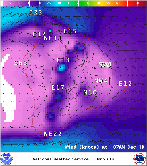
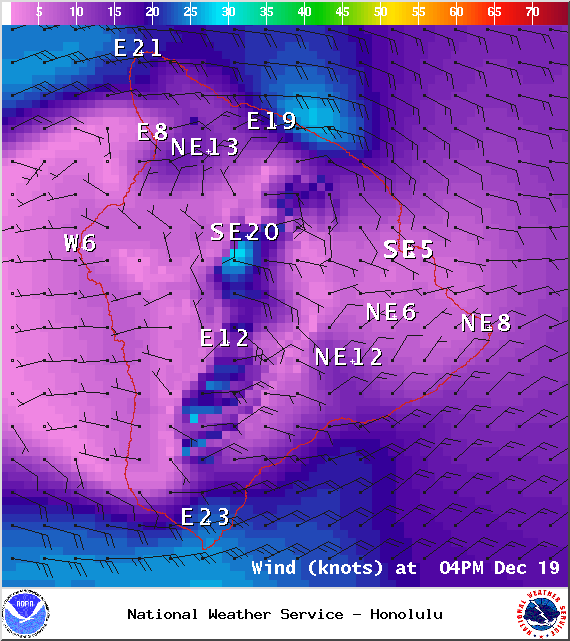
A Small Craft Advisory is posted through 6 p.m. Friday for all Big Island waters. Rough seas up to 15 feet and winds of 15 to 25 knots. Inexperienced mariners should avoid navigating in these conditions.
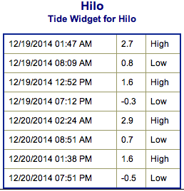
**Click directly on the images below to make them larger. Charts include: Big Island projected winds, tides, swell direction & period and expected wave heights.**
+
SWIPE LEFT OR RIGHT
ARTICLE CONTINUES BELOW AD
ARTICLE CONTINUES BELOW AD
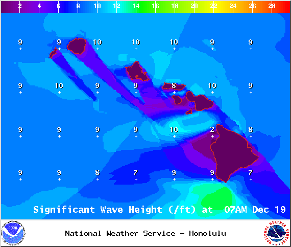
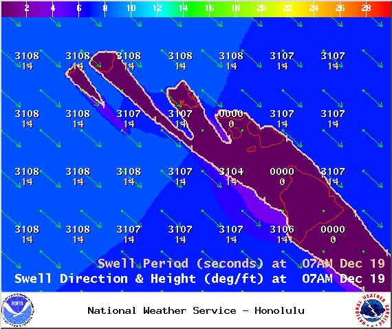
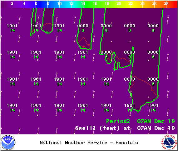
Big Island Surf Forecast, Friday, December 19
Hilo side: Mix of trade wind swell and new northwest swell. Chest to head high surf expected with possible plusses for the best breaks. Choppy and sloppy conditions are forecasted.
Kona side: Surf is expected ankle to waist high. The best breaks may see slightly bigger waves on the sets. Most spots are shadowed from this swell. Some south-southwest energy is still mixing in but not very notable.
South: Mix of trade swell and west-northwest will bring waves knee to shoulder high depending on the exposure. Breaks exposed to the trade swell might get waves shoulder high or more. Meanwhile, breaks exposed to the WNW are around knee to waist high primarily.
ARTICLE CONTINUES BELOW AD
Trade swell will be in the mix for the Hamakua, Puna and Ka’u coastlines through Friday before winds die down and shift out of a more southerly direction over the weekend.
Our current west-northwest is expected to peak on Friday morning head high to overhead on the sets at the best breaks. The Kona side could see some wrap but it won’t be very notable – maybe knee to waist high. Swell expected to fade in the afternoon and through Saturday.
Another west-northwest swell is expected late Sunday and Monday peaking early Monday morning. This swell is expected to show best for the Kona side, but the Hamakua coast will still see some wrap. Mid-week another shot of energy out of the northwest is forecasted to build in as well.
An out of season south swell that brought a fun little boost the last couple of days continues to slowly fade. Another small boost is due in Saturday bringing waist to chest high waves in the afternoon. Otherwise, nothing significant is expected out of the SPAC.
ARTICLE CONTINUES BELOW AD
Keep in mind, surf heights are measured on the face of the wave from trough to crest. Heights vary from beach to beach, and at the same beach, from break to break.
This comments section is a public community forum for the purpose of free expression. Although Big Island Now encourages respectful communication only, some content may be considered offensive. Please view at your own discretion. View Comments


 Big Island Surf Forecast, Friday, December 19
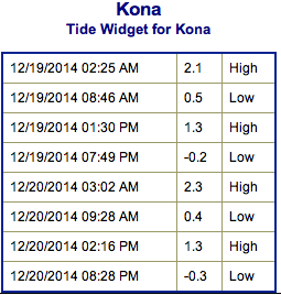 Trade swell will be in the mix for the Hamakua, Puna and Ka’u coastlines through Friday before winds die down and shift out of a more southerly direction over the weekend.