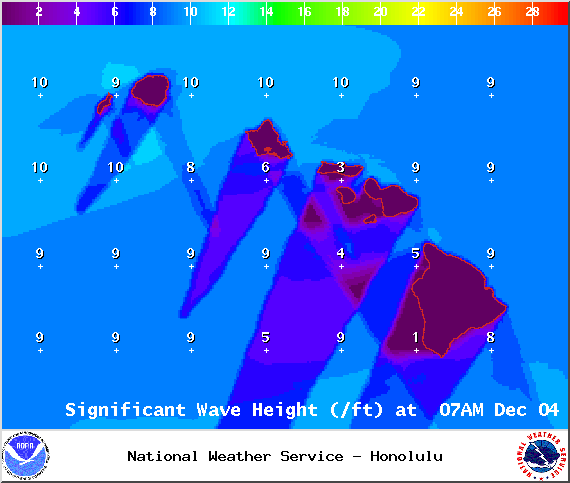
A High Surf Advisory has been issued by the National Weather Service for east-facing shores of the Big Island through 6 p.m. Thursday. Surf is expected from 8 to 12 foot faces.
Expect strong breaking waves, shore break and strong longshore and rip currents making swimming difficult and dangerous.
The Small Craft Advisory has been extended for all Big Island waters until Thursday at 6 p.m. Winds of up to 25 knots are expected and rough seas up to 12 feet. Inexperienced mariners should avoid navigating in these conditions.
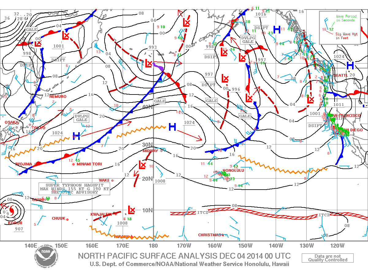
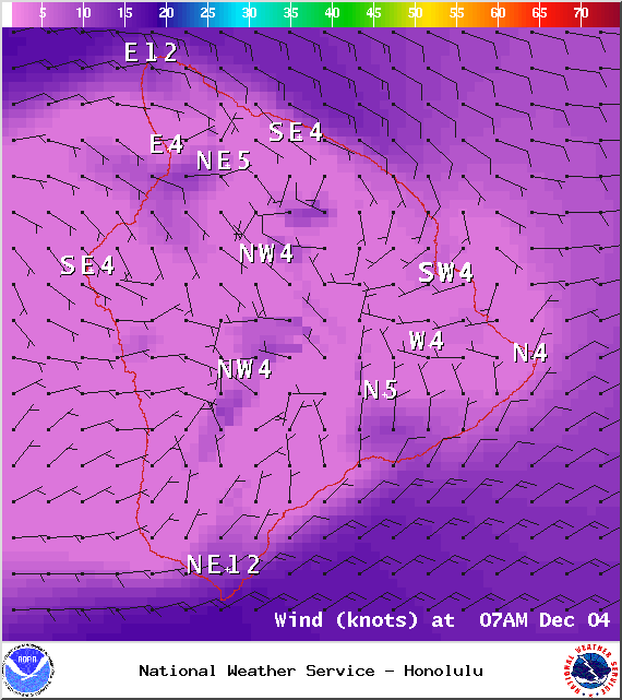
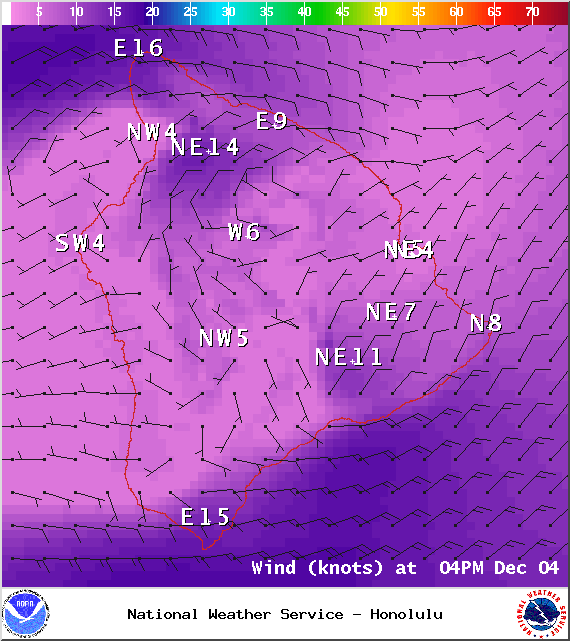
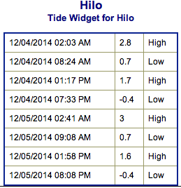
**Click directly on the images below to make them larger. Charts include: Big Island projected winds, tides, swell direction & period and expected wave heights.**
ARTICLE CONTINUES BELOW AD
ARTICLE CONTINUES BELOW AD
+
SWIPE LEFT OR RIGHT
Big Island Surf Forecast, Thursday December 4
Hilo side: Surf is expected head high to well overhead. The best breaks and exposures could see waves reach double overhead.
ARTICLE CONTINUES BELOW AD
Kona side: Surf is expected knee to shoulder high for the best exposures.
South: Southeast shores open to the trade swell could see waves knee to shoulder high, though sloppy and choppy conditions are expected. Minimal surf out of the southern hemisphere – knee high or less. Some wrap from the northeast swell as well.
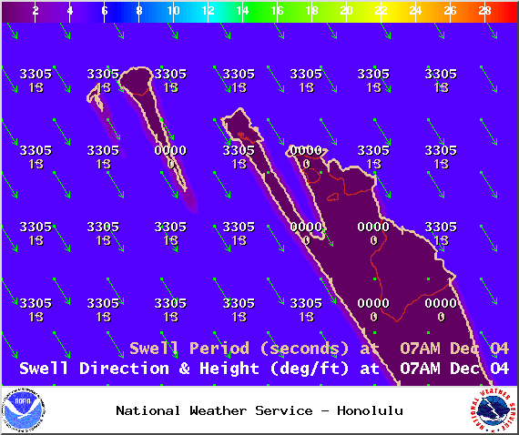
Trade winds are generating swell for windward spots on the Big Island. Conditions will be choppy and sloppy.
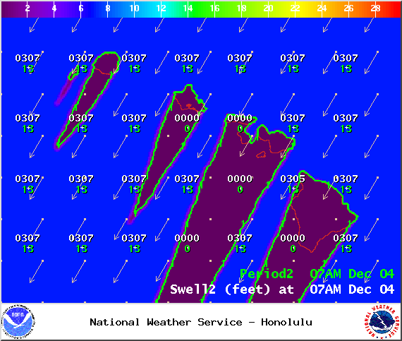
Our current northeast swell is expected to continue to gradually ease today. Our current northwest swell is also slowly fading into the end of the work week.
ARTICLE CONTINUES BELOW AD
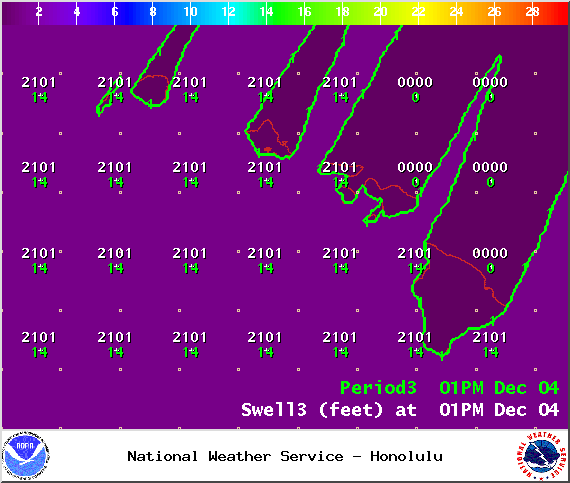
A new north-northwest swell is expected to build Friday into Saturday, peaking near advisory levels. Surf expected from overhead to well overhead, maybe even bigger at the best exposures. A new north-northwest swell is also expected for the weekend and a series of swells beyond that.
Super small trace amounts of swell expected out of the SPAC. Not much to get excited about.
Keep in mind, surf heights are measured on the face of the wave from trough to crest. Heights vary from beach to beach, and at the same beach, from break to break.
This comments section is a public community forum for the purpose of free expression. Although Big Island Now encourages respectful communication only, some content may be considered offensive. Please view at your own discretion. View Comments


 Big Island Surf Forecast, Thursday December 4
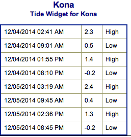 Our current northeast swell is expected to continue to gradually ease today. Our current northwest swell is also slowly fading into the end of the work week.