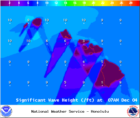
A High Surf Advisory has been issued by the National Weather Service for east-facing shores of the Big Island through 6 p.m. Thursday. Surf is expected from 8 to 12 foot faces.
Expect strong breaking waves, shore break and strong longshore and rip currents making swimming difficult and dangerous.
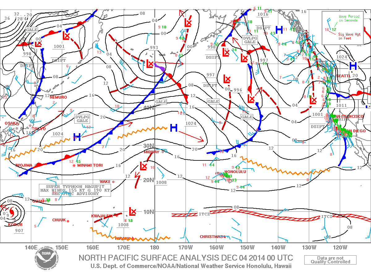
The Small Craft Advisory has been extended for all Big Island waters until Thursday at 6 p.m. Winds of up to 25 knots are expected and rough seas up to 12 feet. Inexperienced mariners should avoid navigating in these conditions.
**Click directly on the images below to make them larger. Charts include: Big Island high/low forecasted temperatures, projected winds, chance of cloud cover, projected localized weather conditions, vog/SO2 forecast and expected wave heights.**
+
SWIPE LEFT OR RIGHT
ARTICLE CONTINUES BELOW AD
ARTICLE CONTINUES BELOW AD
Today, Thursday December 4, 2014
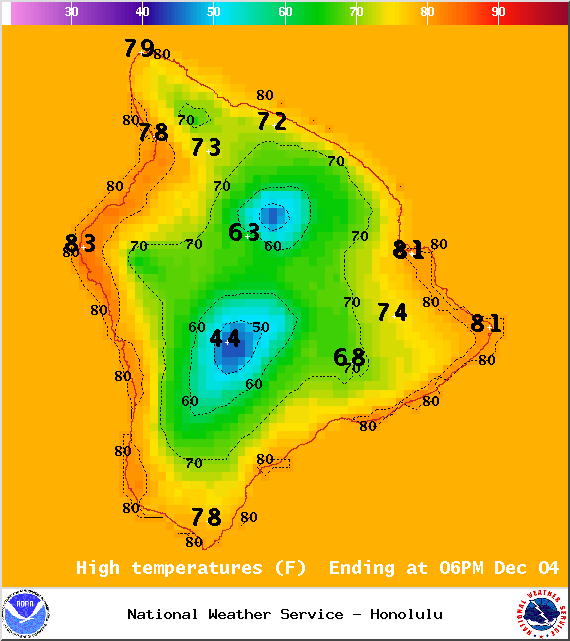
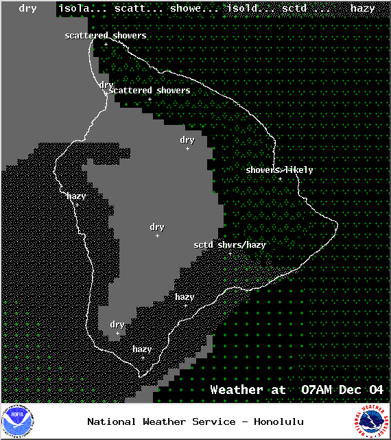
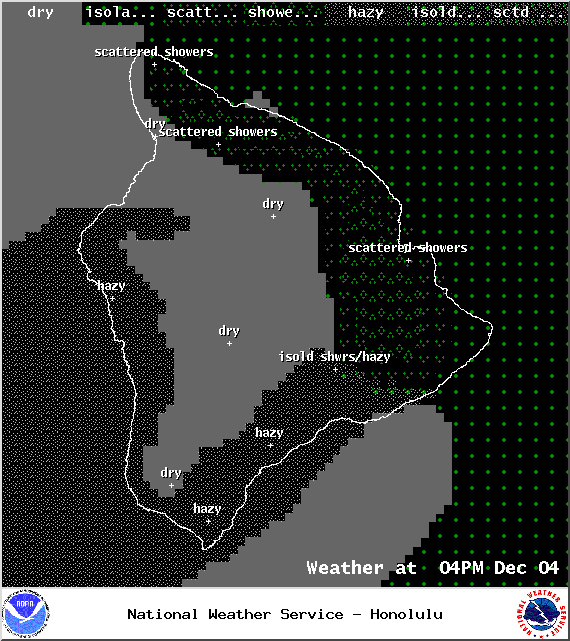
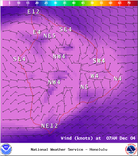
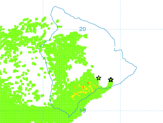
High clouds are expected to stream overhead and obscure the sky from time to time. Mostly cloudy skies are expected for windward and mauka areas today with scattered showers. The Kona side will have a mostly dry morning with afternoon clouds building and isolated showers. Areas of haze will linger on that side as well (see UHSOEST vog model image above). Trade winds are expected from 5 to 20 mph with higher gusts in our usually windier areas. High temperatures should fall in the range of 79° to 84° and around 69° at 5000 feet.
Sunrise: 6:40 a.m.
Sunset: 5:41 p.m.
UV index at 6 (“high” exposure level)
ARTICLE CONTINUES BELOW AD
Tonight
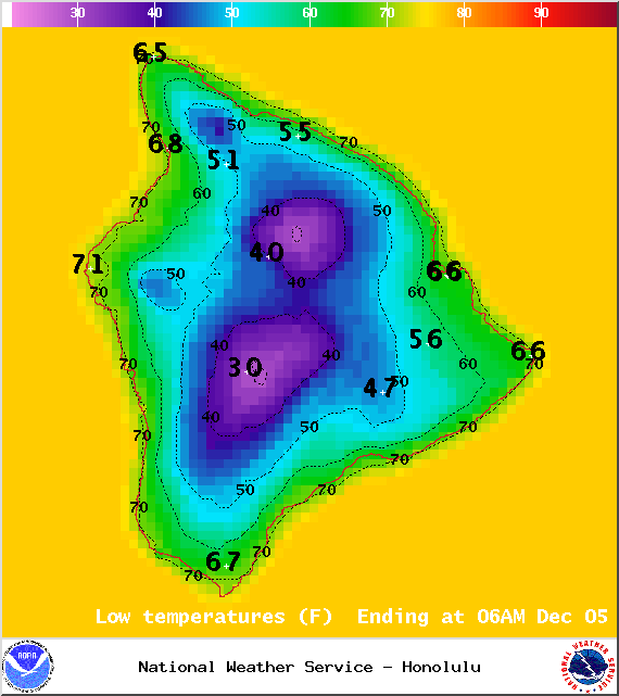
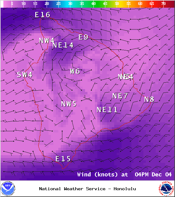
Partly to mostly cloudy skies are expected in windward and mauka areas tonight with likely showers in the forecast. Leeward areas should be mostly cloudy becoming mostly clear as the land breeze kicks in and pushes our clouds out to sea. Winds are out of the northeast from 5 to 20 mph. Low temperatures are expected in the range of 66° to 73° with a low of about 49° at 5000 feet.
Moonrise: 4:38 p.m.
Moonset: 5:55 a.m. on Dec 5
ARTICLE CONTINUES BELOW AD
Next Full Moon: Dec. 6 at 2:27 a.m.
Next New Moon: Dec. 21 at 3:36 p.m.
Looking Ahead
Showers will mainly favor windward and mauka areas. An increase in high cirrus clouds is expected to linger through at least Friday. This will be most noticeable in leeward spots that are usually mostly clear (especially in the mornings). Rainfall may increase slightly and temperatures may drop slightly Friday and into the weekend. Drier conditions are expected Sunday. Winds are forecasted to shift and become light and southerly ahead of a front expected in the Wednesday / Thursday time frame.
This comments section is a public community forum for the purpose of free expression. Although Big Island Now encourages respectful communication only, some content may be considered offensive. Please view at your own discretion. View Comments