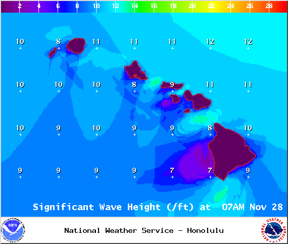
A Small Craft Advisory is posted for all Big Island waters until 6 a.m. Saturday. Winds of 20 to 25 knots are expected and rough seas from 8 to 15 feet. Inexperienced mariners should avoid navigating in these conditions. The advisory for windward Big Island waters is set to expire on Friday at 6 p.m.
A High Surf Advisory is in effect for the north-east facing shores of the Big Island until 6 p.m. Friday. Surf along east facing shores could reach heights of 6 to 9 feet. Expect strong breaking waves, shore break and dangerous currents that make getting into the water hazardous and swimming difficult.
**Click directly on the images below to make them larger. Charts include: Big Island high/low forecasted temperatures, projected winds, chance of cloud cover, projected localized weather conditions, vog/SO2 forecast and expected wave heights.**
+
SWIPE LEFT OR RIGHT
Today, Friday November 28, 2014
ARTICLE CONTINUES BELOW AD
ARTICLE CONTINUES BELOW AD
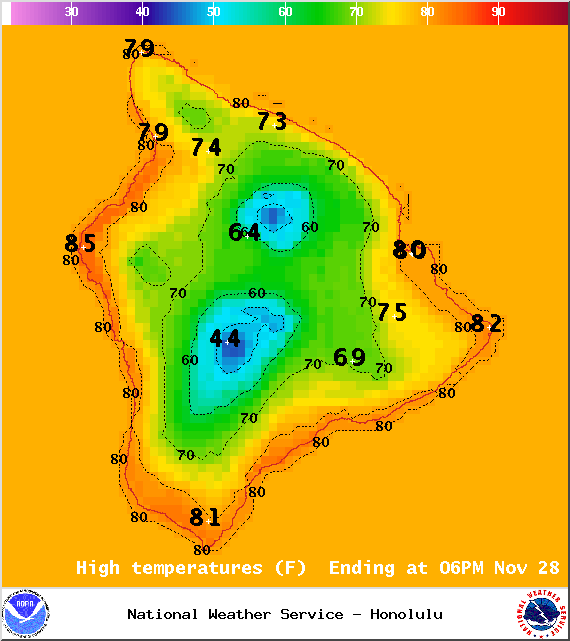
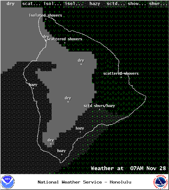
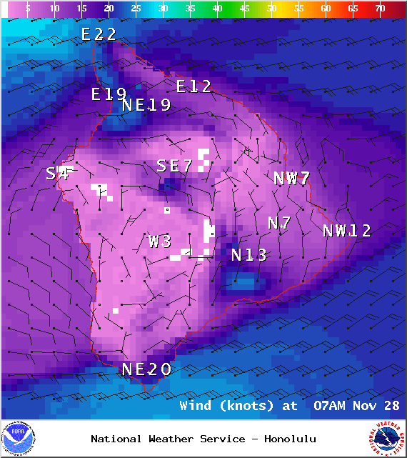
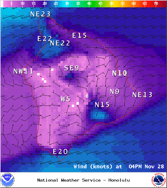
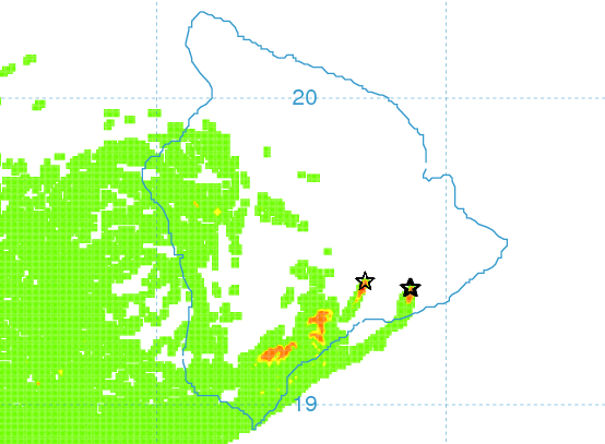
The UHSOEST vog model (pictured above) shows hazy conditions on the leeward side this afternoon, especially from Kona and to the south. Winds are expected out of the northeast from 15 to 25 mph with gusts up to about 40 mph. Leeward areas should be mostly sunny in the morning and mostly cloudy in the afternoon as the sea breeze kicks in due to daytime heating. Windward and mauka areas are forecasted to get mostly cloudy skies with scattered showers. High temperatures should fall in the range of 80° to 85° and around 70° at 5000 feet.
Sunrise: 6:37 a.m.
Sunset: 5:40 p.m.
UV index at 6 (“high” exposure level)
ARTICLE CONTINUES BELOW AD
Tonight
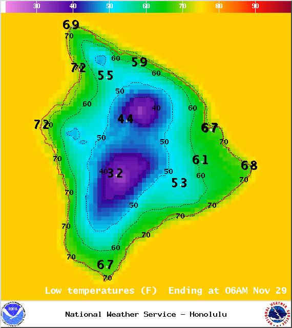
Mostly cloudy skies are expected in windward and mauka areas tonight with scattered showers in the forecast. Leeward areas should be partly cloudy becoming mostly clear as the land breeze kicks in and pushes our clouds out to sea. Winds are out of the northeast from 15 to 25 mph with higher gusts. Low temperatures fare expected in the range of 70° to 75° with a low of about 51° at 5000 feet.
Moonrise: 12:04 p.m.
Moonset: 12:09 a.m.
Next Full Moon: Dec. 6 at 2:27 a.m.
ARTICLE CONTINUES BELOW AD
Next New Moon: Dec. 21 at 3:36 p.m.
Looking Ahead
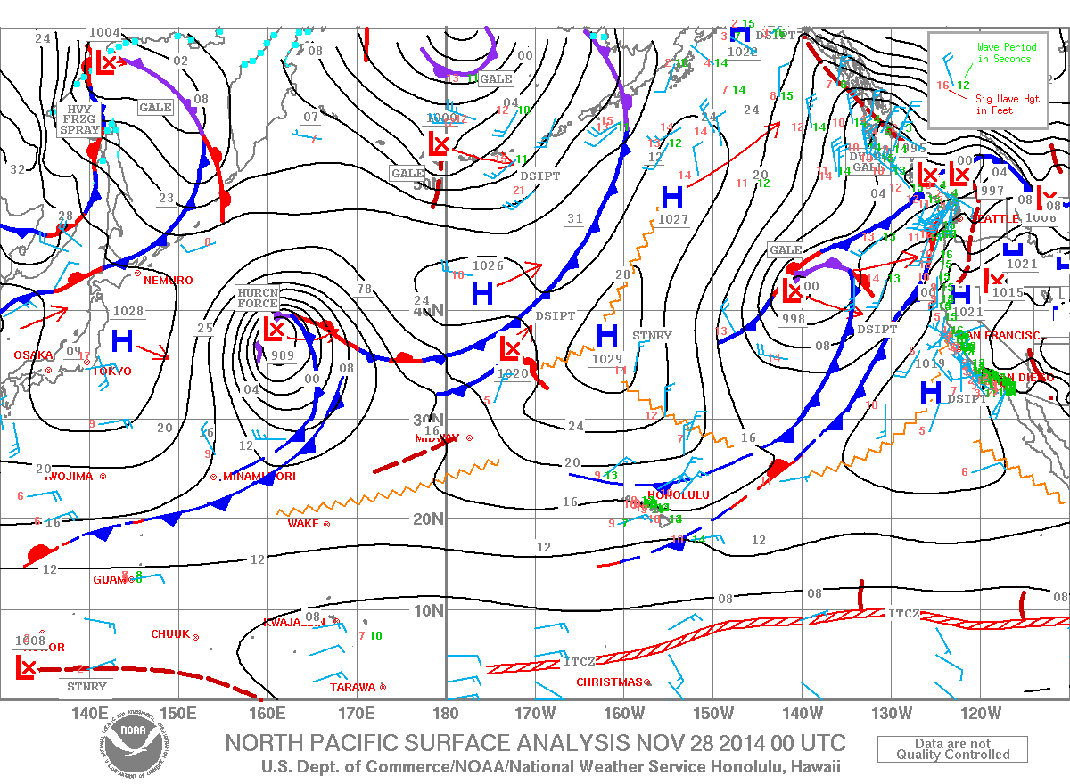
High pressure is churning out our trade winds and they are pretty strong. We expect to have these breezy trades through the holiday weekend. Lingering moisture will continue to bring scattered showers to windward areas. Leeward spots should be dry. Trade wind speeds are forecasted to drop slightly early next week. The forecast will be updated daily and as necessary so check back for any changes.
This comments section is a public community forum for the purpose of free expression. Although Big Island Now encourages respectful communication only, some content may be considered offensive. Please view at your own discretion. View Comments