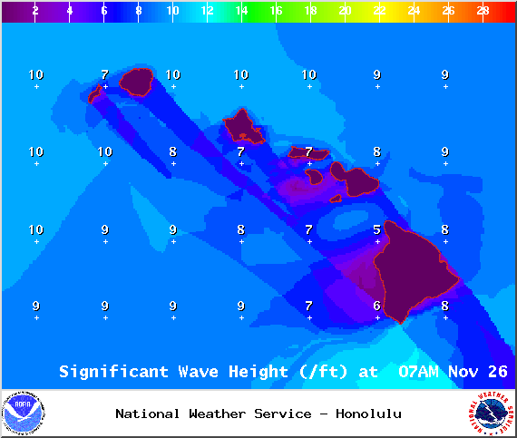
A High Surf Advisory is in effect for the north and east facing shores of the Big Island for a larger than expected north-northeast swell. Surf along north facing shores could reach heights of 12 to 15 feet. Surf along east facing shores could reach heights of 8 to 12 feet. The advisory is set to expire at 6 p.m. on Thursday.
Expect strong breaking waves, shore break and dangerous currents that make getting into the water hazardous and swimming difficult.
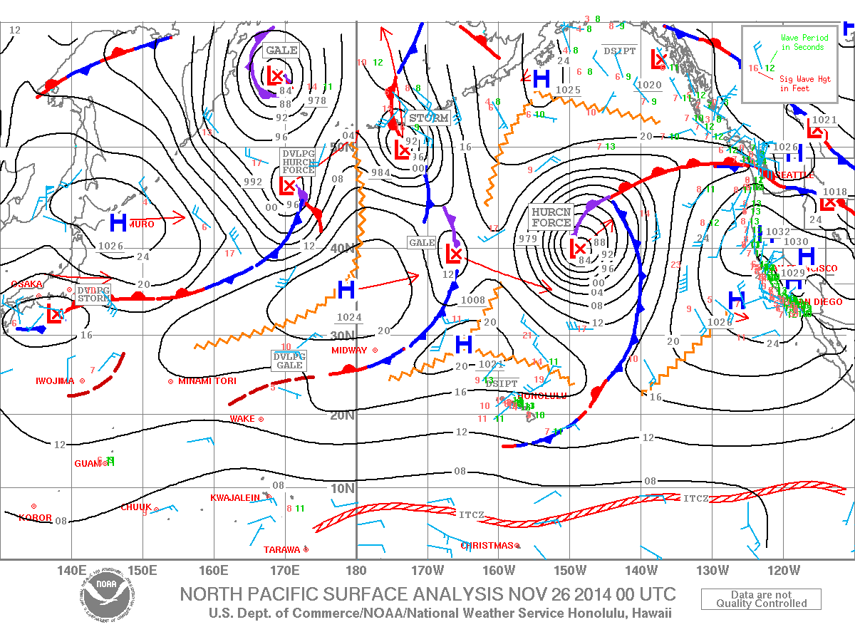
A Small Craft Advisory is posted for the ʻAlenuihāhā channel and Big Island windward and southeast waters until 6 a.m. Thursday. Winds from 20 to 25 knots are expected out of the northeast and rough seas up to 13 feet. Inexperienced mariners should avoid navigating in these conditions.
**Click directly on the images below to make them larger. Charts include: Big Island high/low forecasted temperatures, projected winds, chance of cloud cover, projected localized weather conditions, vog/SO2 forecast and expected wave heights.**
+
SWIPE LEFT OR RIGHT
ARTICLE CONTINUES BELOW AD
ARTICLE CONTINUES BELOW AD
Today, Wednesday November 26, 2014
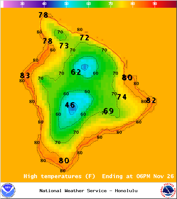
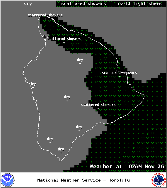
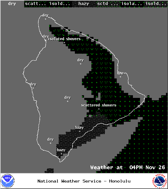
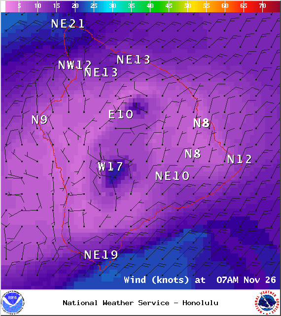
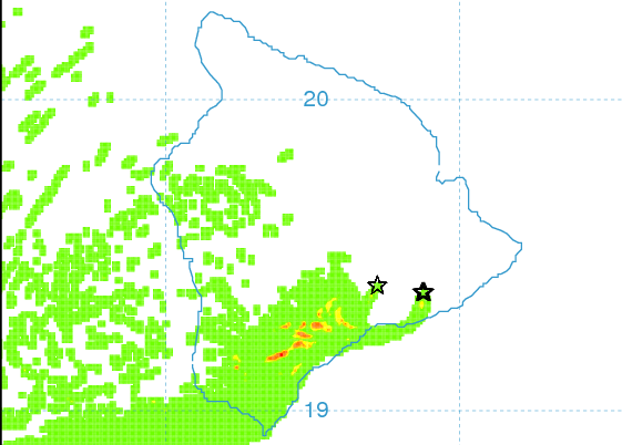
Partly sunny skies are expected today for the Big Island. Windward and mauka areas are forecasted to get morning scattered showers then isolated showers in the afternoon. The Kona side is expected to get sunshine early on before some clouds begin to build in the afternoon. The UHSOEST vog model (pictured above) shows less haze on the leeward side this afternoon than we experienced yesterday. Winds are expected out of the north from 15 to 20 mph with higher gusts. High temperatures should fall in the range of 79° to 84° and around 70° at 5000 feet.
Sunrise: 6:35 a.m.
Sunset: 5:40 p.m.
UV index at 6 (“high” exposure level)
ARTICLE CONTINUES BELOW AD
Tonight
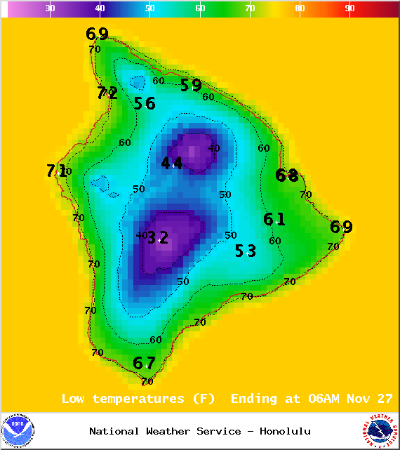
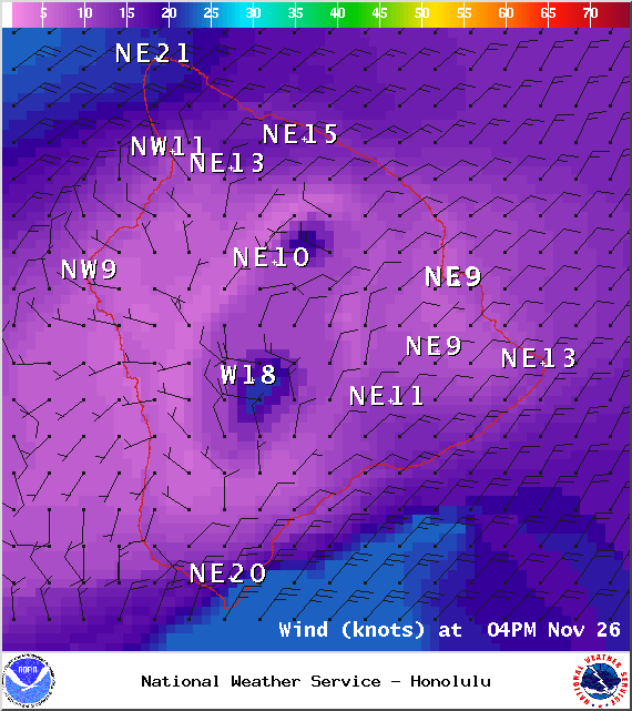
Partly to mostly cloudy skies are expected in windward and mauka areas tonight with scattered showers in the forecast. Leeward areas should be mostly clear. Winds are out of the northeast from 15 to 20 mph. Low temperatures fare expected in the range of 70° to 75° with a low of about 51° at 5000 feet.
Moonrise: 10:27 a.m.
Moonset: 10:10 p.m.
ARTICLE CONTINUES BELOW AD
Next Full Moon: Dec. 6 at 2:27 a.m.
Next New Moon: Dec. 21 at 3:36 p.m.
Looking Ahead to the Thankgiving Holiday Weekend
Your Thanksgiving forecast calls for trade wind weather with showers focusing in windward and mauka areas in the morning and evening hours and leeward spots getting lots of morning sunshine. Winds will be breezy through Saturday. Sunday lighter winds are in the forecast. A wetter trade wind day may come Friday when the remnants of an old front reaches us. Otherwise, we are looking a dry trade wind regime for the rest of this week and the weekend. This cool weather will continue for another day before warmer seasonal temps return. Even so, the wind chill factor will come into play due to the breezy trades which will make one feel chilly or colder than it actually is.The forecast will be updated daily and as necessary so check back for any changes.
Almanac for Hilo Airport
Maximum Temperature for today:
Normal 80°
Record 86° / Set in 1977 and tied in 1990 and 2005
Minimum Temperature for today:
Normal 67°
Record 62° / Set in 1958 and tied in 1973 and 1989
This comments section is a public community forum for the purpose of free expression. Although Big Island Now encourages respectful communication only, some content may be considered offensive. Please view at your own discretion. View Comments