We tied a record low temperature in Hilo yesterday. At 6:26 a.m. we hit a low temperature of 62°. This ties the old record set in 1983. Normal for this time of year is 67°, our record is a departure of 5° from normal.
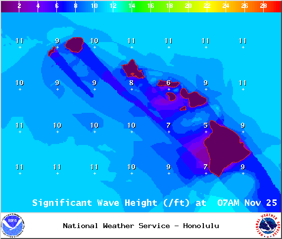
A Small Craft Advisory is posted for all Big Island waters until 6 p.m. Wednesday. Winds around 25 knots are expected out of the northeast and rough seas of 7 to 15 feet. Inexperienced mariners should avoid navigating in these conditions.
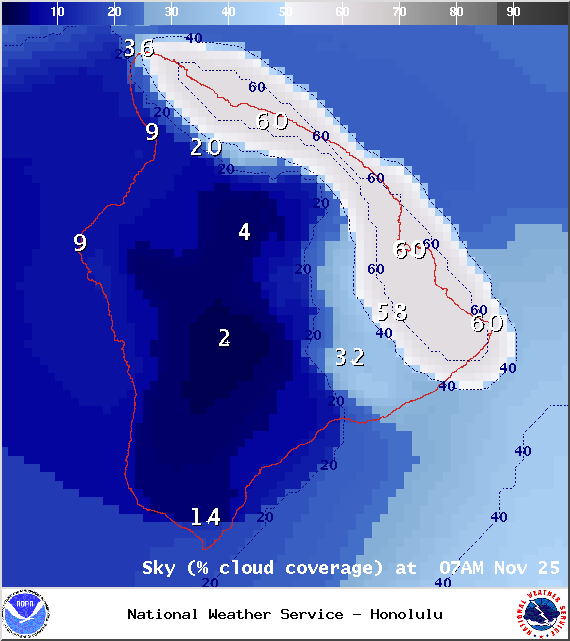
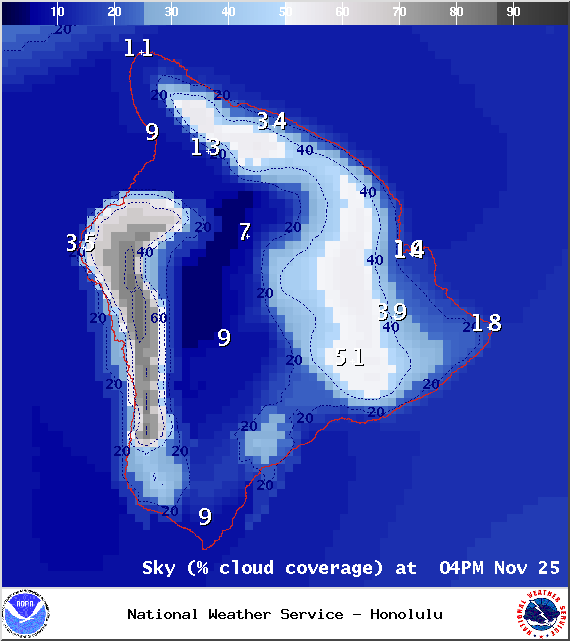
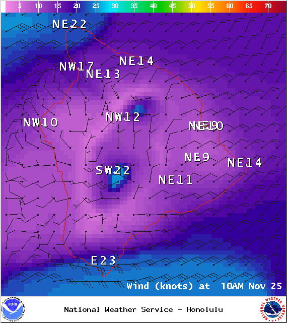
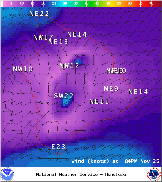
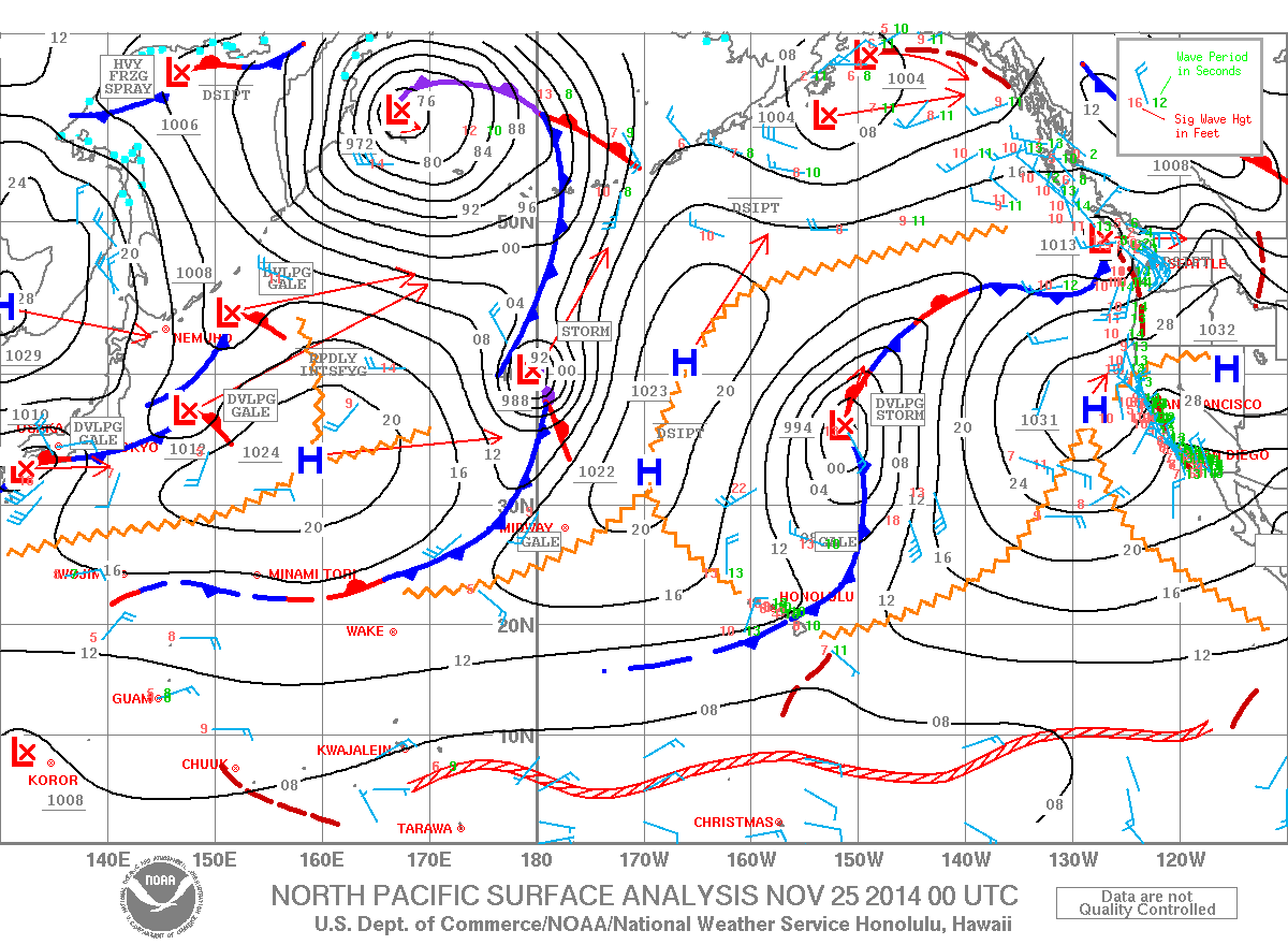
**Click directly on the images below to make them larger. Charts include: Big Island high/low forecasted temperatures, projected winds, chance of cloud cover, projected localized weather conditions, vog/SO2 forecast and expected wave heights.**
+
SWIPE LEFT OR RIGHT
Today, Tuesday November 25, 2014
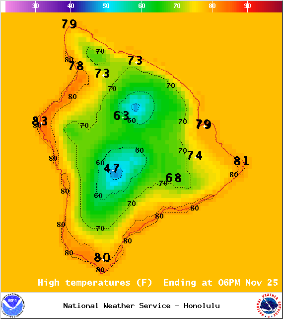
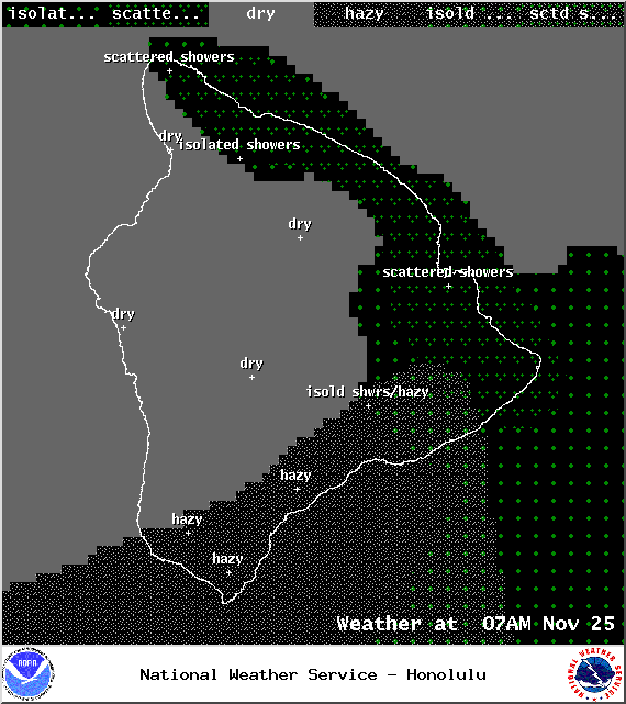
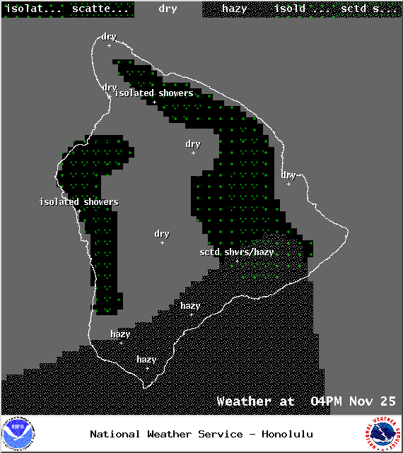
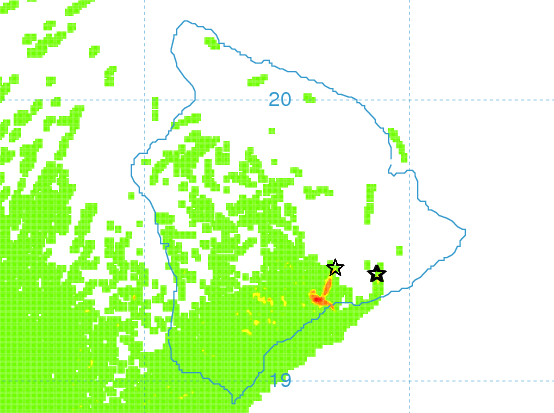
Mostly sunny skies are expected today with scattered morning windward and mauka showers. By the afternoon isolated showers are expected. On the Kona side lots of morning sunshine with partly sunny skies and scattered showers forecasted in the afternoon. The UHSOEST vog model (pictured above) shows haze lingering on the leeward side in the afternoon. Winds are expected out of the northeast from 15 to 25 mph. High temperatures should fall in the range of 78° to 83° and around 70° at 5000 feet.
ARTICLE CONTINUES BELOW AD
ARTICLE CONTINUES BELOW AD
Sunrise: 6:35 a.m.
Sunset: 5:40 p.m.
UV index at 6 (“high” exposure level)
Tonight
ARTICLE CONTINUES BELOW AD
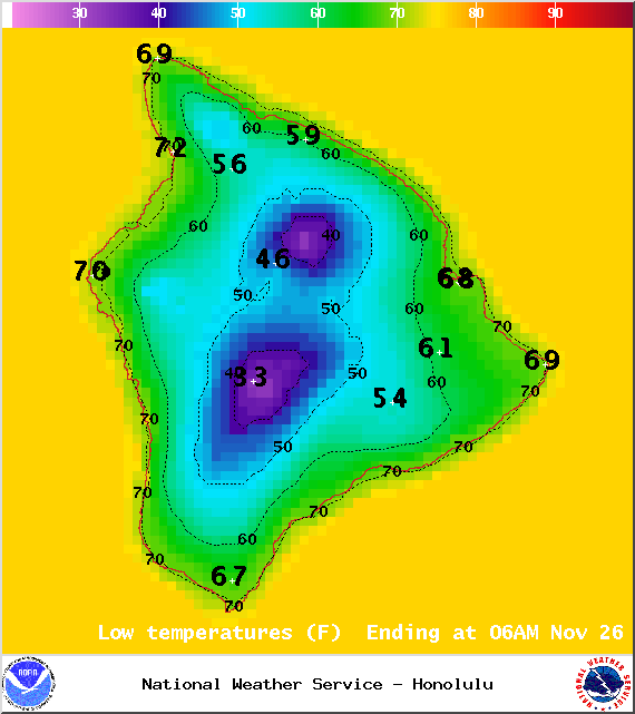
Mostly clear skies are expected in Hawaii County tonight. Winds are out of the northeast from 15 to 20 mph. Another crisp night in store for us with low temperatures falling in the range of 63° to 68° with a low of about 51° at 5000 feet.
Moonrise: 9:35 a.m.
Moonset: 9:10 p.m.
Next Full Moon: Dec. 6 at 2:27 a.m.
Next New Moon: Dec. 21 at 3:36 p.m.
ARTICLE CONTINUES BELOW AD
Looking Ahead
A weakening front has pushed through the island chain and leaves cool, crisp, dry conditions in its wake. Winds will veer out of the northeast today and locally breezy trade winds will stick around through the work week. An increase in showers is expected toward the end of the work week when we get back to more typical trade wind weather.
This comments section is a public community forum for the purpose of free expression. Although Big Island Now encourages respectful communication only, some content may be considered offensive. Please view at your own discretion. View Comments