The National Weather Service allowed the High Surf Advisory and Wind Advisory to expire earlier this morning.
However, a reinforcing north northwest swell arriving later today may once again push surf heights to the high surf advisory criteria. This elevated surf will likely continue through Friday.
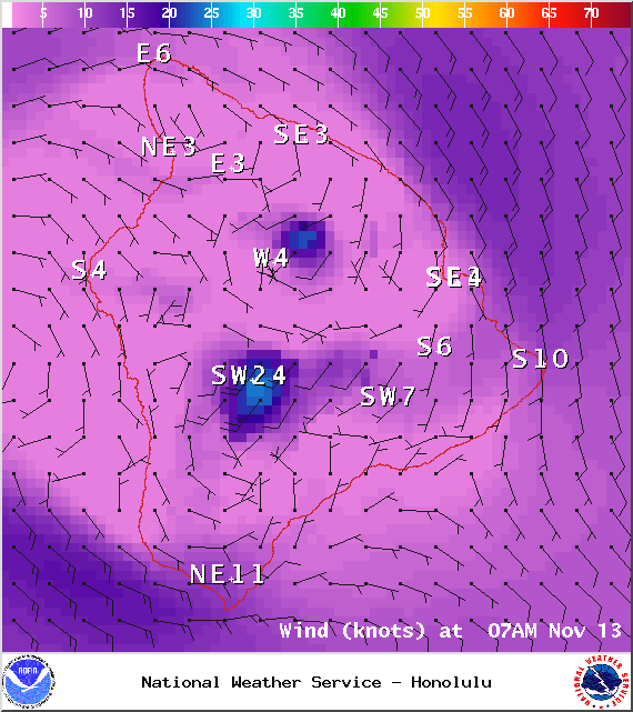
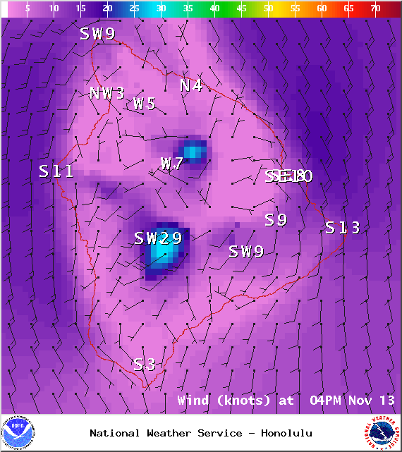
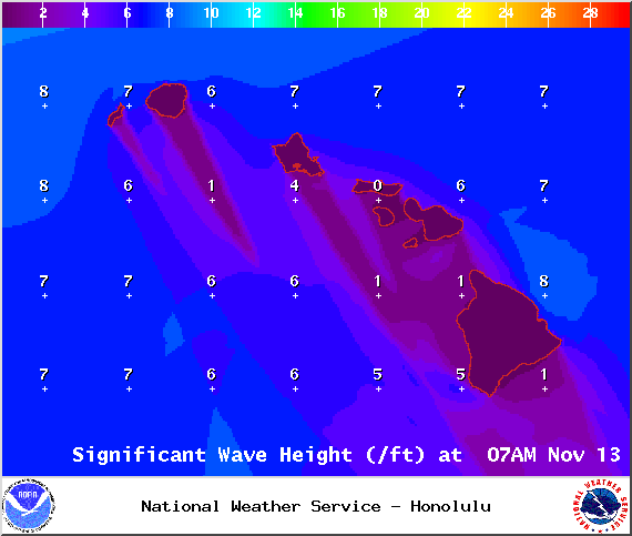
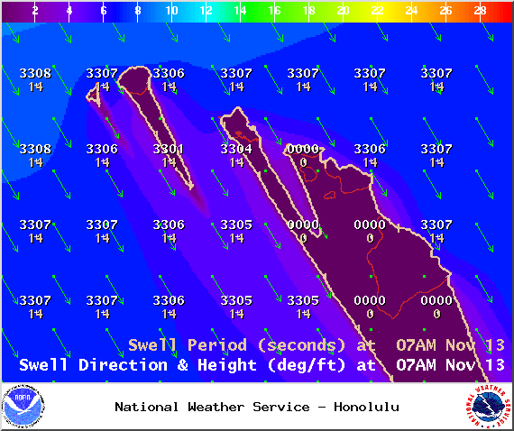
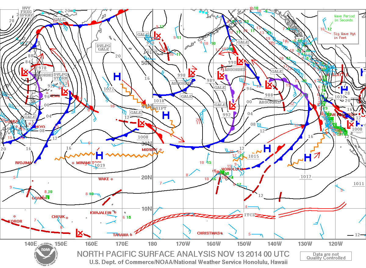
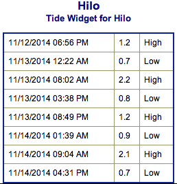
**Click directly on the images below to make them larger. Charts include: Big Island projected winds, tides, swell direction & period and expected wave heights.**
ARTICLE CONTINUES BELOW AD
ARTICLE CONTINUES BELOW AD
+
SWIPE LEFT OR RIGHT
Big Island Surf Forecast, Thursday November 13, 2014
Hilo side: Surf is expected double to triple overhead for spots best exposed to the north-northwest swell. Current swell fading while new swell builds in late today.
ARTICLE CONTINUES BELOW AD
Kona side: Breaks not exposed to the swells will be flat today. Spots that catch some of the north-northwest wrap could see waves knee to chest high.
South: Waves expected waist high or less.
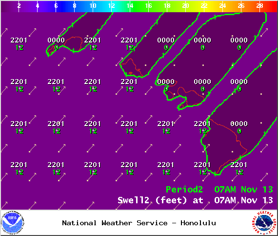
Mahalo to former Super Typhoon Nuri for generating an exciting swell the last couple of days. The current northwest swell (310-335°) is expected to slowly fade today. The Kona side is shadowed from the swell and will be significantly smaller but may still catch a wrap at the best exposed breaks.
ARTICLE CONTINUES BELOW AD
A new north-northwest swell (325-350°) is right on its heels, expected to elevate surf above the high surf advisory threshold later today and through Friday. Hilo side and along the Hamakua coast up to Kohala is where the swell will show best. We’re looking at overhead to double overhead surf at the best breaks. The Kona side again is heavily shadowed but is still expected to get a small portion of the swell energy to wrap. Saturday the swell will start to fade. That trend is expected to continue through Sunday.
Super small trace amounts of swell expected out of the SPAC. Most Kona spots will remain flat. There isn’t much on the horizon out of the South Pacific.
Keep in mind, surf heights are measured on the face of the wave from trough to crest. Heights vary from beach to beach, and at the same beach, from break to break.
**Click here for your detailed Big Island weather report.**
This comments section is a public community forum for the purpose of free expression. Although Big Island Now encourages respectful communication only, some content may be considered offensive. Please view at your own discretion. View Comments


 Big Island Surf Forecast, Thursday November 13, 2014
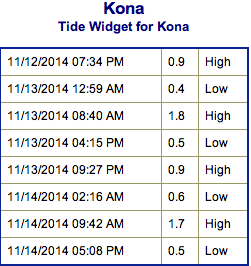 A new north-northwest swell (325-350°) is right on its heels, expected to elevate surf above the high surf advisory threshold later today and through Friday. Hilo side and along the Hamakua coast up to Kohala is where the swell will show best. We’re looking at overhead to double overhead surf at the best breaks. The Kona side again is heavily shadowed but is still expected to get a small portion of the swell energy to wrap. Saturday the swell will start to fade. That trend is expected to continue through Sunday.