The National Weather Service allowed the High Surf Advisory and Wind Advisory to expire at 6:00 a.m.
However, a reinforcing north northwest swell arriving later today is expected to once again push surf heights to the high surf advisory criteria along most north and west facing shores of the smaller Hawaiian islands. This elevated surf will likely continue through Friday.
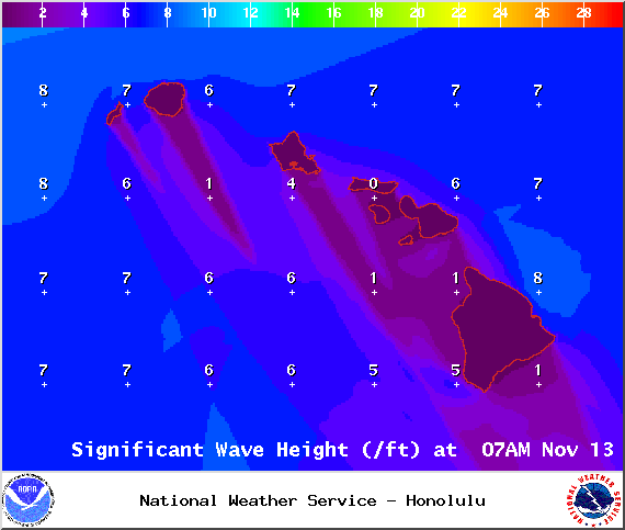
***Click directly on the images below to make them larger. Charts include: Big Island high/low forecasted temperatures, projected winds, chance of cloud cover, projected localized weather conditions, vog/SO2 forecast and expected wave heights.***
+
SWIPE LEFT OR RIGHT
Thursday November 13
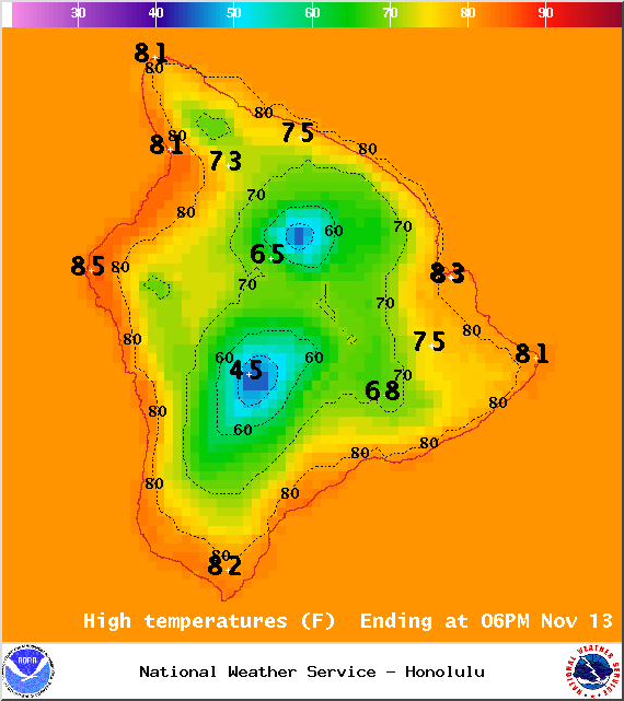
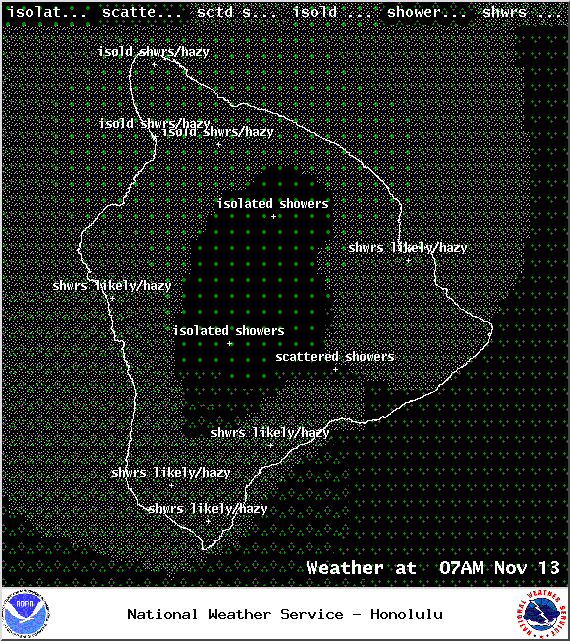
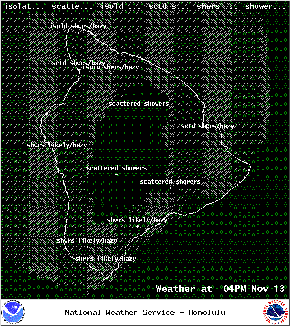
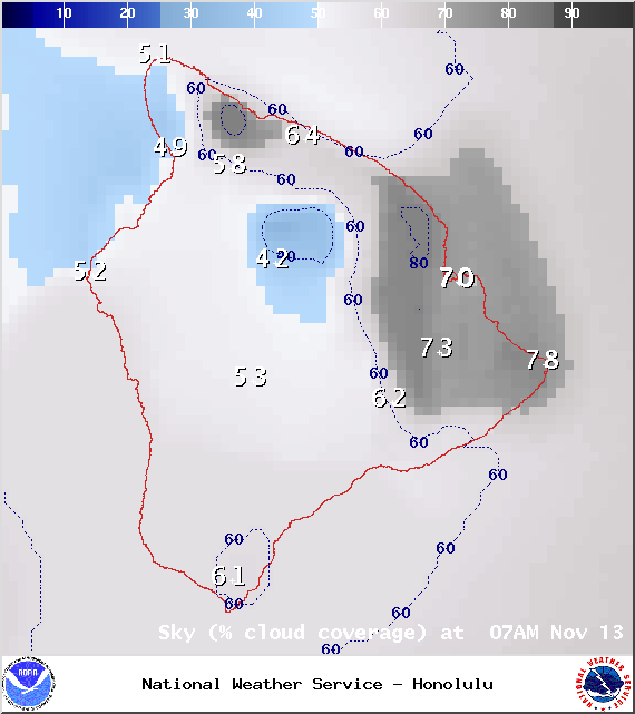
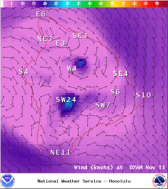
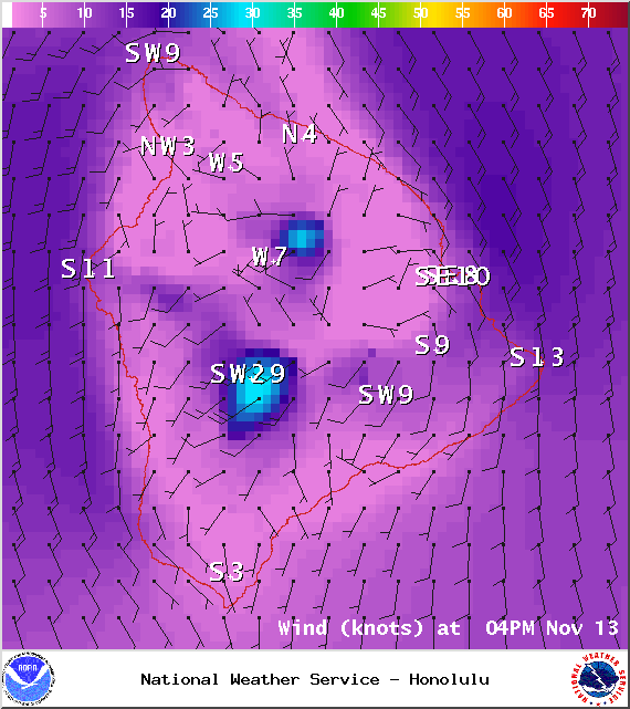
We expect areas of haze across the Big Island today, including the Hilo side. Partly sunny skies are forecasted with isolated showers for windward areas and showers likely for leeward spots as an area of enhanced moisture pushes in from the south. Prefrontal moisture is also forecasted to impact Hawaii County this afternoon and into the evening. High temperatures should fall in the range of 81° to 86° and around 72° at 5000 feet. In general, southwest winds around 15 mph are expected with higher gusts.
ARTICLE CONTINUES BELOW AD
ARTICLE CONTINUES BELOW AD
Sunrise: 6:28 a.m.
Sunset: 5:41 p.m.
UV index at 7 (“high” exposure level)
Tonight
ARTICLE CONTINUES BELOW AD
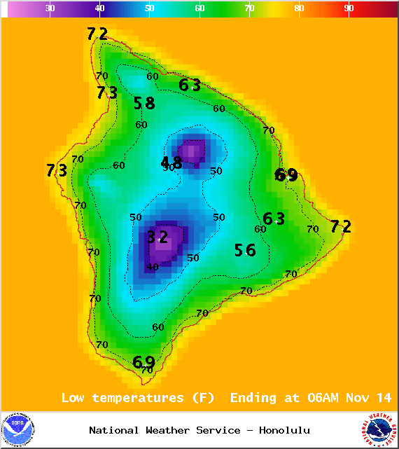
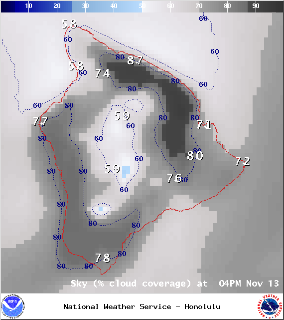
We expect mostly cloudy skies tonight with scattered showers and areas of haze. Southwest winds from 15 – 20 mph are forecasted. Low temperatures should fall in the range of 71° to 76° with a low of about 55° at 5000 feet. The moon is 62.8% full.
Moonrise: 11:53 p.m.
Moonset: 12:44 p.m.
Next New Moon: Nov 22 at 2:33 a.m.
Next Full Moon: Dec 6 at 2:27 a.m.
ARTICLE CONTINUES BELOW AD
Looking Ahead
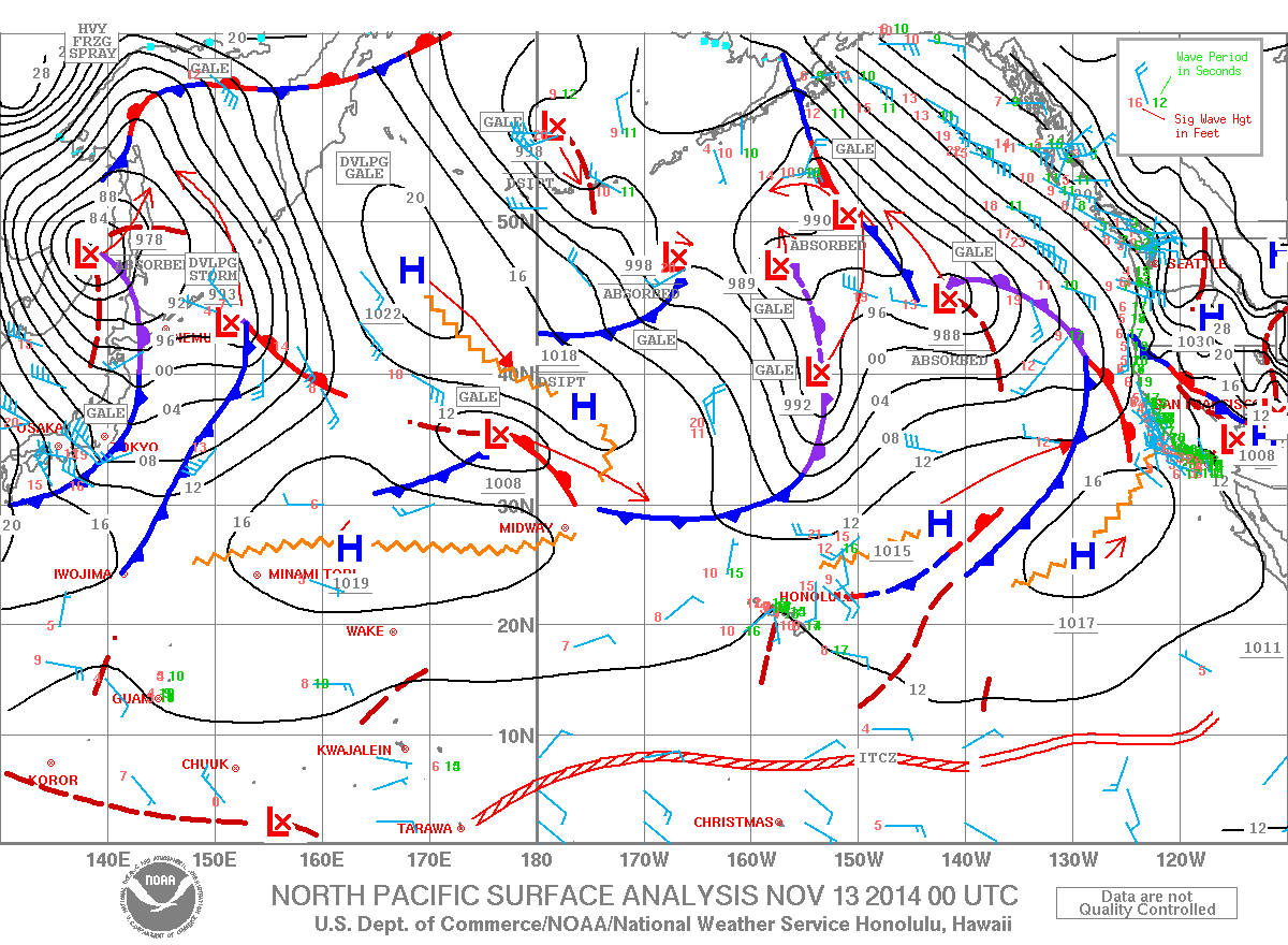
A front that stalled over Oahu on Tuesday is expected to linger and help draw moisture up from the south and over the Big Island today. These showers will be quite disorganized and scattered in nature. A second front is expected to bring prefrontal moisture to Maui County and the Big Island this afternoon and into the evening. As the front pushes down the island chain Saturday and Sunday, moisture from the deep tropics that is lingering in our area coupled with unstable conditions aloft may be enough to fuel substantial rainfall and even thunderstorms over the weekend. Will keep an eye on it. Cooler, drier conditions are expected early next week.
This comments section is a public community forum for the purpose of free expression. Although Big Island Now encourages respectful communication only, some content may be considered offensive. Please view at your own discretion. View Comments