A HIGH SURF ADVISORY was issued by the National Weather Service for the northeast facing shores of the Big Island. It will go into effect from 9:00 pm this evening until 6:00 am Wednesday morning for waves building to 10 – 20 feet for north facing shores.
Expect strong breaking waves, shore break and strong currents making swimming difficult and dangerous. Anyone entering the water could face significant injury due to the dangerous hazards this swell will pose. Boaters are asked to be aware of the increased number of surfers likely to be in the water.
A SMALL CRAFT ADVISORY will be posted for Big Island windward waters from 9:00 pm this evening through 6:00 am Wednesday morning. Rough seas from 6 – 12 feet are expected. Inexperienced mariners should avoid navigating in these conditions.
Today
ARTICLE CONTINUES BELOW AD
ARTICLE CONTINUES BELOW AD
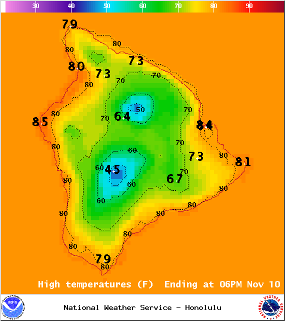
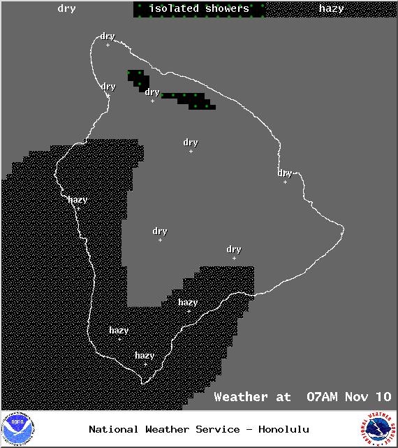
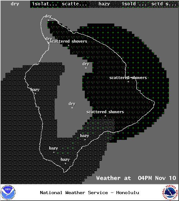
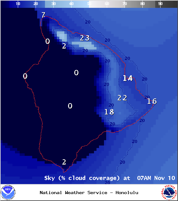
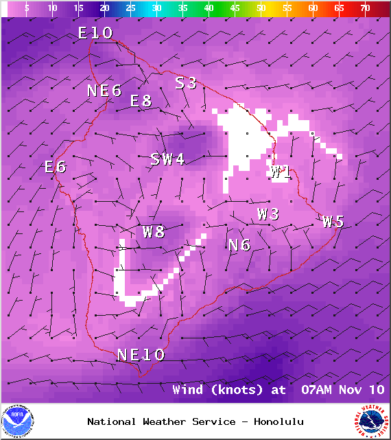
We expect hazy skies especially in leeward spots. Partly cloudy skies and scattered showers are forecasted for windward and mauka areas. High temperatures should fall in the range of 80° to 86° and up to 70° at 5000 feet. Variable winds up to 15 mph are expected.
Sunrise: 6:26 a.m.
Sunset: 5:42 p.m.
UV index at 7 (“high” exposure level)
ARTICLE CONTINUES BELOW AD
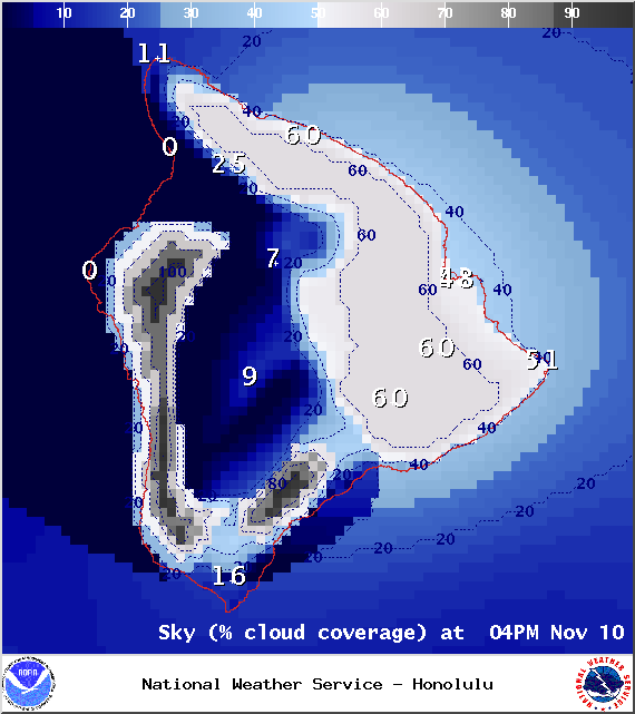
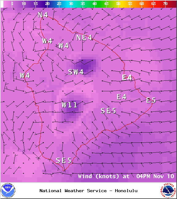
**Click directly on the images below to make them larger. Charts include: Big Island high/low forecasted temperatures, projected winds, chance of cloud cover, projected localized weather conditions, vog/SO2 forecast and expected wave heights.**
+
SWIPE LEFT OR RIGHT
Tonight
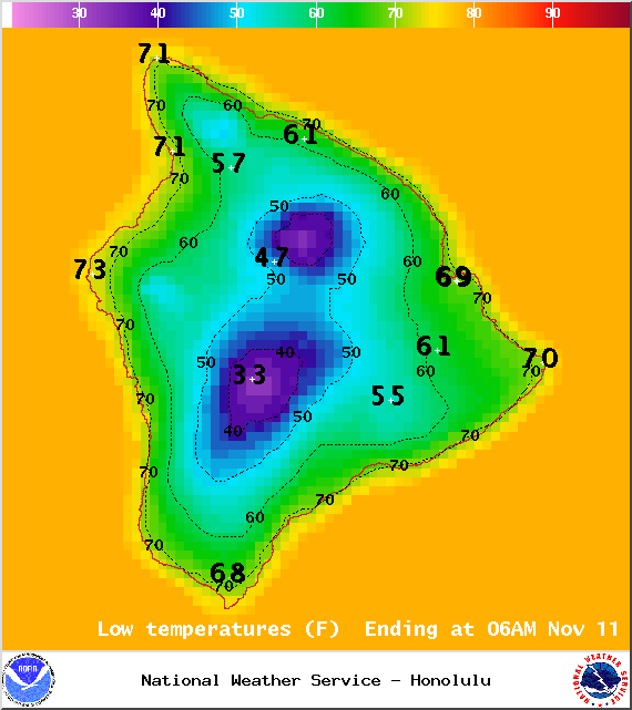
We expect partly cloudy skies tonight with isolated showers for windward and mauka areas. Leeward spots should begin to clear as the land breeze takes hold. Variable winds are expected up to 15 mph. Low temperatures should fall in the range of 67° to 73° with a low of about 57° at 5000 feet. The moon is 87.3% full.
Moonrise: 9:23 p.m.
ARTICLE CONTINUES BELOW AD
Moonset: 10:40 a.m.
Next New Moon: Nov 22 at 2:33 a.m.
Next Full Moon: Dec 6 at 2:27 a.m.
Looking Ahead
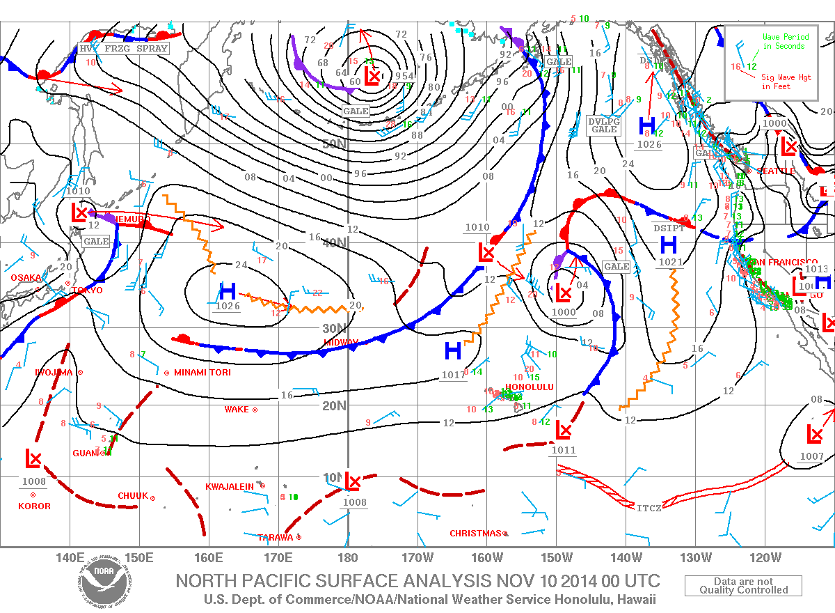
The northerly winds that followed the front are becoming lighter and more easterly. A dry pattern of daytime sea breezes and nighttime land breezes is expected through Veteran’s Day. That means lots of morning sunshine in leeward and interior spots with cloud cover building in the afternoon. If showers occur they should be limited and short-lived. The second half of the week, winds are expected to veer out of the south-southwest as a cold front approaches and it could get wet. Will keep an eye on the models and bring you the latest.
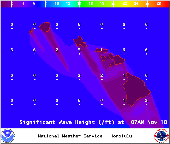
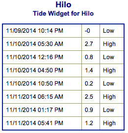
Surf & Seas
Hilo side: Surf is expected in the waist to chest high range for spots best exposed to the trade swell. The north-northwest is expected to head high to slightly overhead waves to the best breaks exposed to the swell, especially early in the day.
Kona side: Surf is expected to be thigh high or less. Breaks not exposed to the swell will be flat today. Spots that catch some of the north-northwest wrap could see waves waist high or less.
South: Best breaks could see waves up to waist high for spots exposed to the trade swell along the southeast coast. South breaks that are not exposed to the trade swell should see waves thigh high or less.
Our current north-northwest swell (320-345°) is fading through the day. Even so, it should still offer overhead to possibly double overhead wave heights through the morning, easing to head high by sundown.
Former super typhoon Nuri made history. After becoming extratropical and merging with a frontal system a couple of days ago, the storm became the strongest non-tropical storm ever recorded in the NPAC.
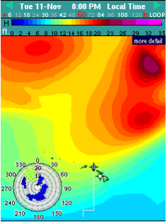
The system is expected to bring us a solid northwest swell (310-335°) building through Veteran’s day, peaking in the afternoon with overhead to double overhead waves, maybe even bigger sets at the best exposures despite being heavily shadowed. The Kona side will be significantly smaller but may still catch a wrap at the best breaks.
A series of northwest and north-northwest swells is expected to bring swell energy through the weekend with a couple of reinforcing swells showing up on models for early next week as well.
Small swells generated in the South Pacific are expected to bring us waves in the thigh high or less range and gradually fade through the week. Most Kona spots will remain flat. There isn’t much on the horizon out of the South Pacific.
Keep in mind, surf heights are measured on the face of the wave from trough to crest. Heights vary from beach to beach, and at the same beach, from break to break.
This comments section is a public community forum for the purpose of free expression. Although Big Island Now encourages respectful communication only, some content may be considered offensive. Please view at your own discretion. View Comments


 Surf & Seas
 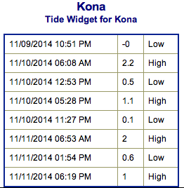 Our current north-northwest swell (320-345°) is fading through the day. Even so, it should still offer overhead to possibly double overhead wave heights through the morning, easing to head high by sundown.