**A breakdown of expected conditions specific to the Big Island is presented below. All graphics are provided by the National Weather Service in Honolulu. Click directly on the image to make it larger.**
+
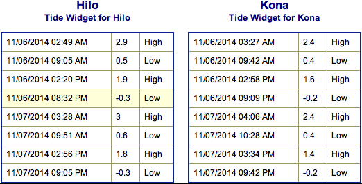
SWIPE LEFT OR RIGHT
Today
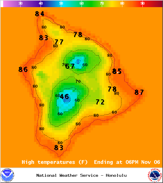
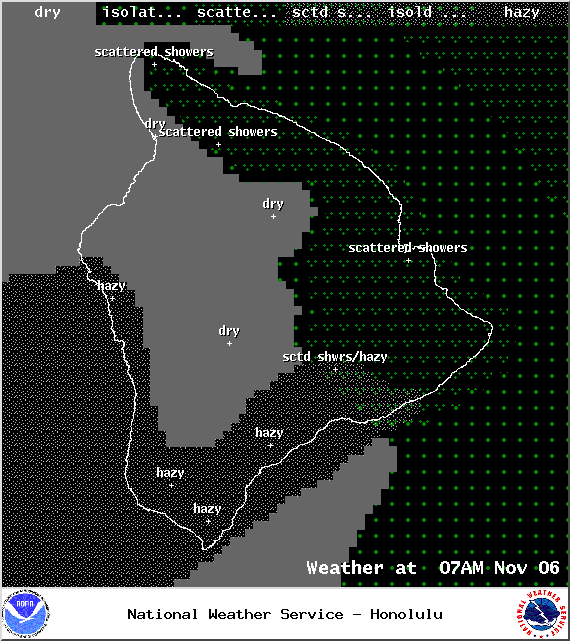
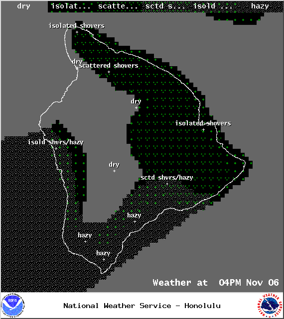
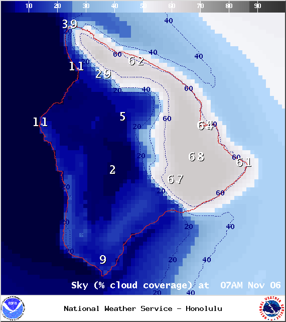
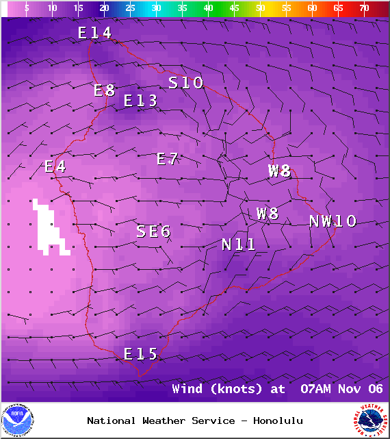
Today we expect partly sunny skies for windward spots with scattered morning showers. Sunny skies on the Kona side with our usual daytime heating contributing to building cloud cover in the afternoon. Hazy skies and isolated afternoon showers are also expected on that side of the island. High temperatures should fall in the range of 82° to 87° and around 73° at 5000 feet. In general, east winds up to 15 mph are expected.
Sunrise: 6:24 a.m.
Sunset: 5:44 p.m.
UV index at 7 (“high” exposure level)
ARTICLE CONTINUES BELOW AD
ARTICLE CONTINUES BELOW AD
Tonight
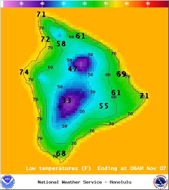
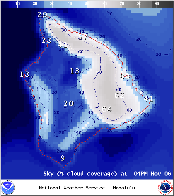
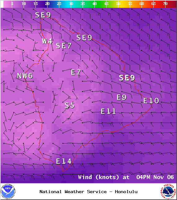
We expect partly cloudy skies tonight with isolated showers for windward and mauka areas becoming scattered after midnight. The Kona side is expected to be mostly clear with areas of haze hanging around. Low temperatures should fall in the range of 69° to 74° with a low of about 57° at 5000 feet. Variable winds are expected up to 15 mph.
Moonrise: 5:58 p.m.
Moonset: 7:11 a.m.
ARTICLE CONTINUES BELOW AD
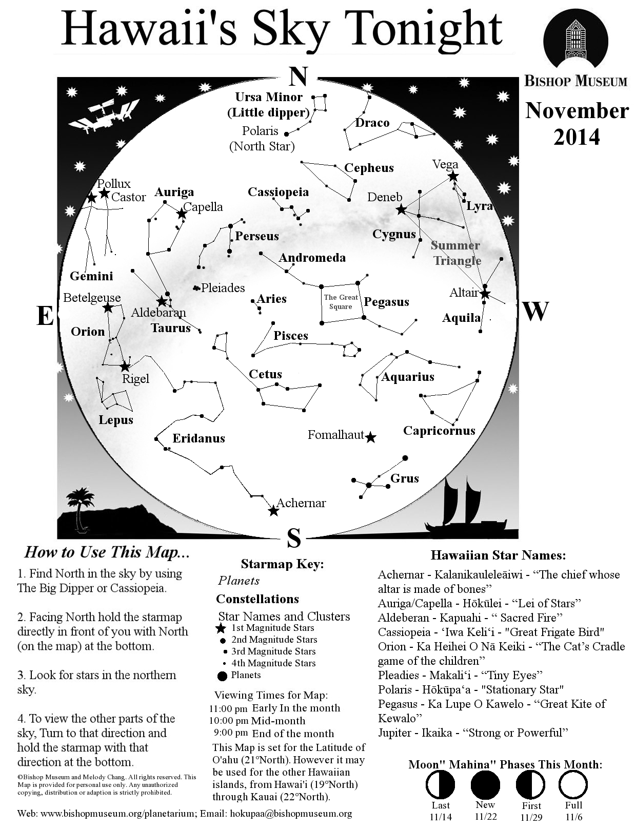
Next Full Moon: Today at 12:23 p.m.
Next New Moon: Nov 22 at 2:33 a.m.
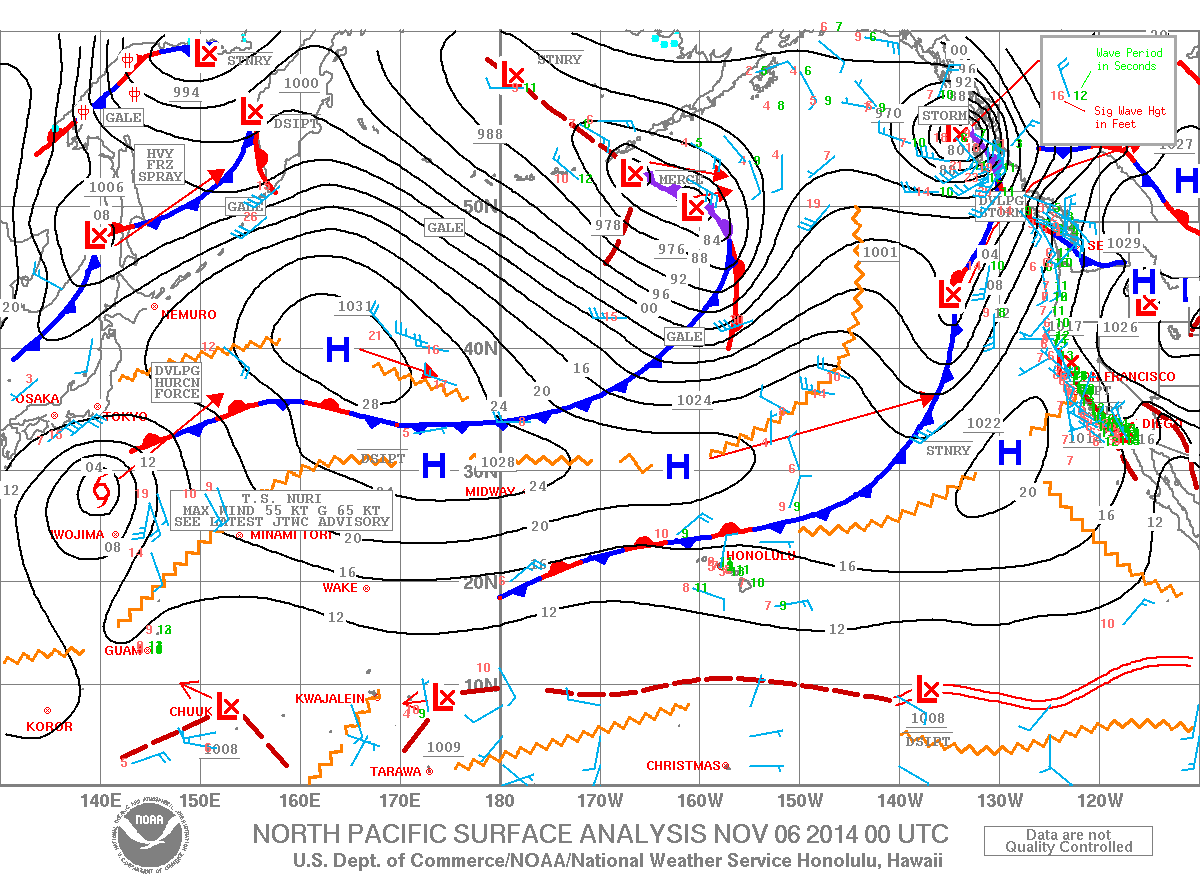
Looking Ahead
Another front is expected to approach the island chain starting today, this will cut our trade winds off again. At this point the front is expected to impact Hawaii County on late Saturday night through Sunday night. Briefly strong trade winds are expected to follow the front.
ARTICLE CONTINUES BELOW AD
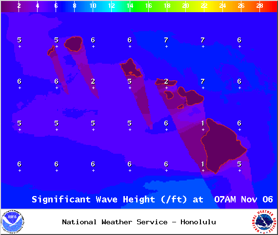
Surf & Seas
Hilo: Surf is expected in the thigh to shoulder high range with some plusses for spots best exposed to the mix of trade swell and north-northwest.
Kona: Surf is expected to be thigh high or less. Breaks not exposed to the swell will be flat today.
South: Best breaks could see waist to shoulder high waves for spots exposed to the trade swell along the southeast coast. South breaks that are not exposed to the trade swell should see waves thigh high or less.
Our current north-northwest swell (325-355°) is bringing waves in the thigh to shoulder high range with some plusses for our best exposures. The Kona side is not expected to catch much of this swell. Maybe an even bigger swell (320-345°) on the horizon for next weekend, possibly peaking with waves well overhead. Typhoon Nuri could possibly bring us a solid swell starting around 11/10 and peaking 11/11 in the chest to overhead range for best spots.
Small swells generated in the South Pacific are expected to bring us waves in the thigh high or less range. You might see possible plusses at the best tides and exposures but they will be inconsistent at best and most Kona spots will remain flat. There isn’t much on the horizon out of the South Pacific.
Keep in mind, surf heights are measured on the face of the wave from trough to crest. Heights vary from beach to beach, and at the same beach, from break to break.
Almanac for Hilo Airport
Maximum Temperature for today:
Normal 81°
Record 87° / Set in 1988 and tied in 1996 and 2004
This comments section is a public community forum for the purpose of free expression. Although Big Island Now encourages respectful communication only, some content may be considered offensive. Please view at your own discretion. View Comments


 Surf & Seas