**A breakdown of expected conditions specific to the Big Island is presented below in graphical form. All graphics are provided by the National Weather Service in Honolulu.**
Alerts
The SMALL CRAFT ADVISORY has been extended for waters near South Point, Big Island leeward waters and the Alenuihaha channel until 6 p.m. Monday, Nov. 3, 2014. Rough seas are expected from 6 to 12 feet. Winds are forecasted out of the east from 20 to 25 knots, with higher gusts. Inexperienced mariners are cautioned to avoid navigating in these conditions.
Today
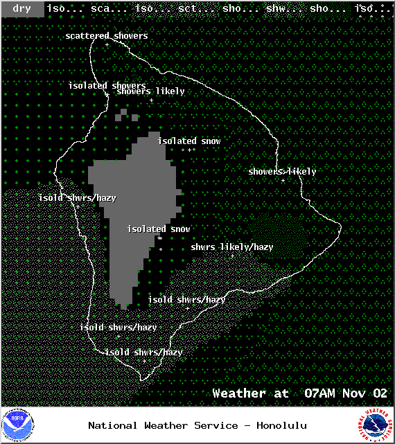
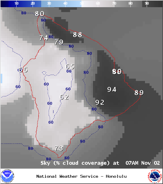
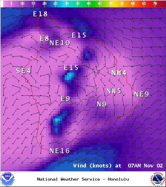
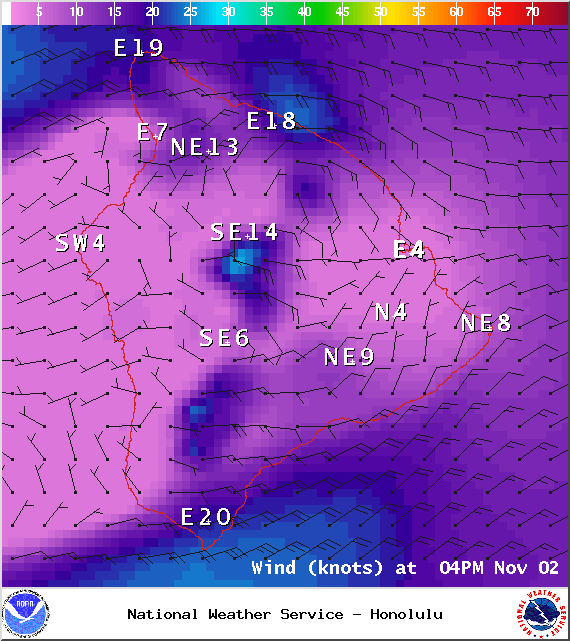
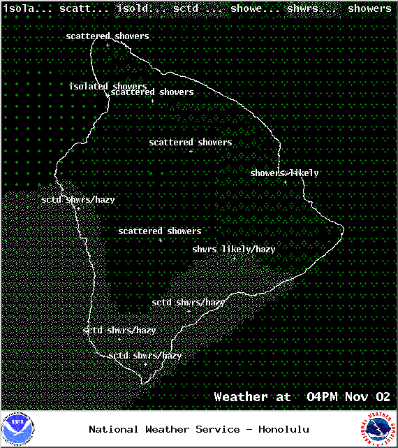
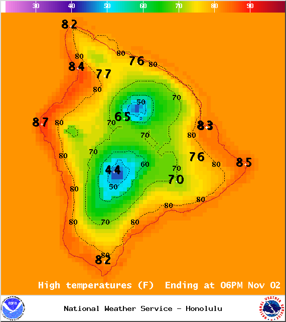
The wet trade wind weather pattern is expected to continue with mostly cloudy skies for windward and mauka areas during the day. Some of those clouds will squeeze out scattered showers. Localized downpours are possible due to instability in our area. The Kona side is expected to get scattered showers in the afternoon and hazy skies. High temperatures should fall in the range of 83° to 88° up to around 73° at 5000 feet. In general, trade winds should fall in the 10 – 20 mph range. Along the Hamakua coast and at South Point winds could gust up to 35 mph. In the Waikoloa and Kohala areas gusts could reach 30 mph.
Sunrise: 6:22 a.m.
Sunset: 5:45 p.m.
UV index at 7 (“high” exposure level)
Tonight
We expect mostly cloudy skies tonight with showers likely for windward and mauka areas. The Kona side will be mostly cloudy in the evening but gradually clearing as the night goes on. Low temperatures should fall in the range of 71° to 76° with a low of about 56° at 5000 feet. Trade winds are expected from 10 – 20 mph.
ARTICLE CONTINUES BELOW AD
ARTICLE CONTINUES BELOW AD
Moonrise: 2:51 p.m.
Moonset: 3:14 a.m.
Next Full Moon: Nov 6, 2014 at 12:23 p.m.
Next New Moon: Nov 22, 2014 at 2:33 a.m.
Looking Ahead
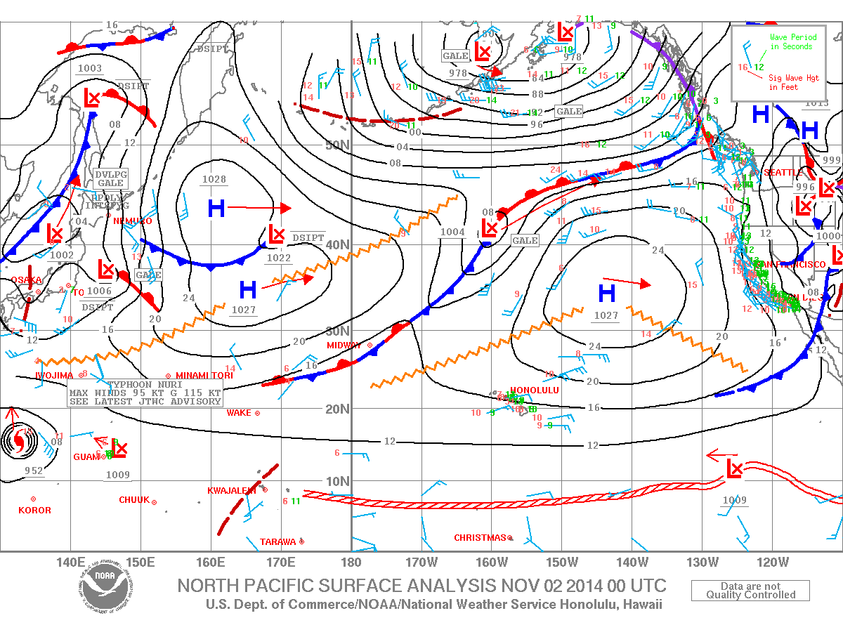
Trade winds are expected to gradually weaken over the next couple of days. Trade showers are expected to continue through the weekend dampening windward sides and even pushing some showers over to leeward areas from time to time. The forecast is a bit tricky though because of a weather feature in our area that is making conditions unstable. Last night this feature flared up thunder and lightning for some areas on the windward coast. This upper low should shift west over the next 30 hours or so. On Monday, trade winds are expected to decrease further. By midweek trades should start filling back in. Another front is expected to affect us next week as well.
Surf & Seas Hilo: Surf is expected in the head high range. Spots best exposed to the swell could see overhead sets from time to time. Kona: Surf from ankle to waist high is forecasted. Breaks not exposed to the swell will see the smaller surf. South: Waist to chest high waves are expected. The southeast coast will also catch the trade swell bringing waves heights up to head high at the best exposures.
Our north swell (350-360°) is fading through Monday. A new northwest swell (315-350°) is expected to peak in the waist to chest high range late Tuesday. This swell is expected to hold through the end of the work week.
ARTICLE CONTINUES BELOW AD
A moderate trade wind swell is affecting our eastern shores.
Our current south-southwest swell (200-180°) is expected to hold today before fading out early next week. After that swell subsides, surf goes quiet with not much on the horizon out of the South Pacific.
Keep in mind, surf heights are measured on the face of the wave from trough to crest. Heights vary from beach to beach, and at the same beach, from break to break.
Almanac for Hilo Airport Maximum Temperature for today:
Normal 82°
Record 87° / Set in 1976 and tied in 1993
ARTICLE CONTINUES BELOW AD
Minimum Temperature for today:
Normal 68°
Record 62° / Set in 1980
This comments section is a public community forum for the purpose of free expression. Although Big Island Now encourages respectful communication only, some content may be considered offensive. Please view at your own discretion. View Comments


 Today
Today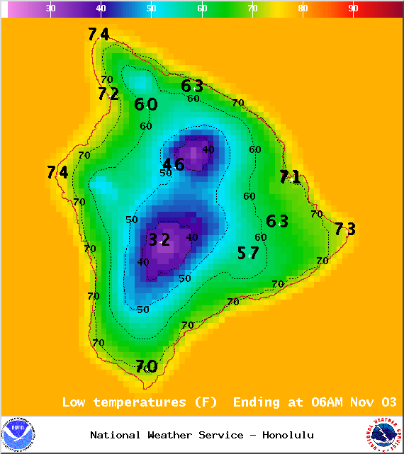 Tonight
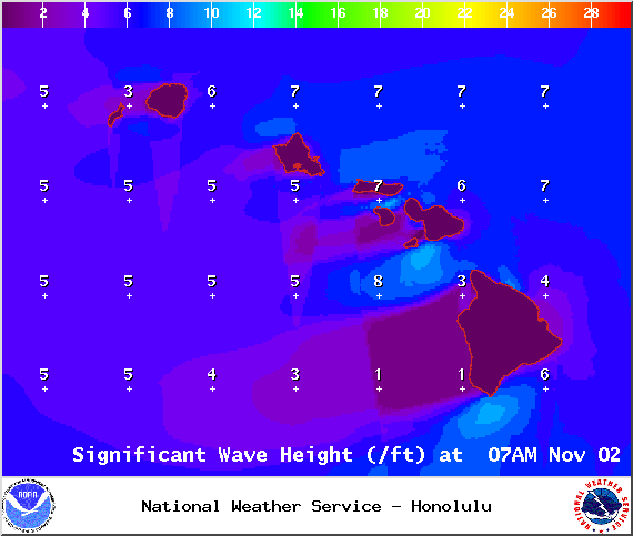 Surf & Seas
 A moderate trade wind swell is affecting our eastern shores.