**A breakdown of expected conditions specific to the Big Island is presented below in graphical form. High and low temperatures, swell, percent chance of clouds / rain and wind conditions are each depicted. All graphics are provided by the National Weather Service in Honolulu.** Alerts
There are no alerts posted for Hawai’i County at this time.
Today
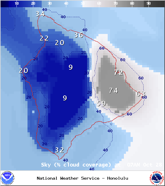
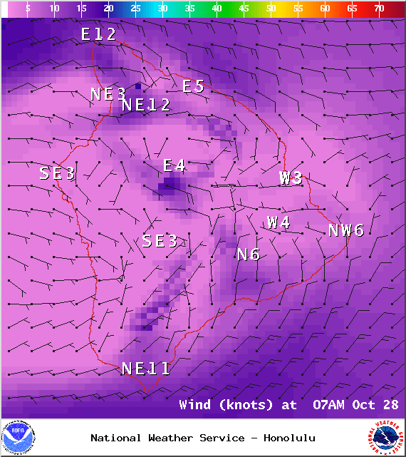
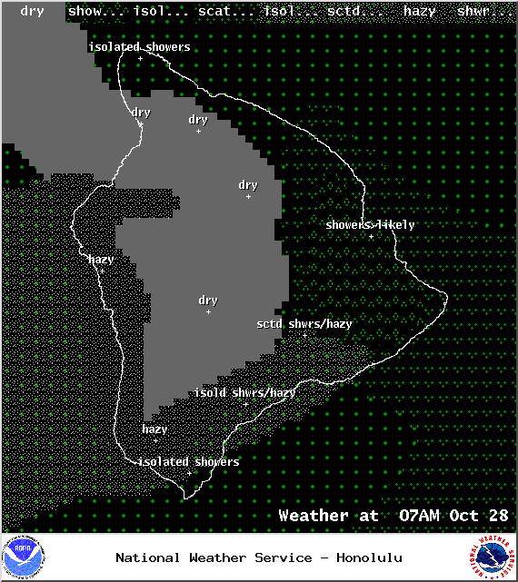
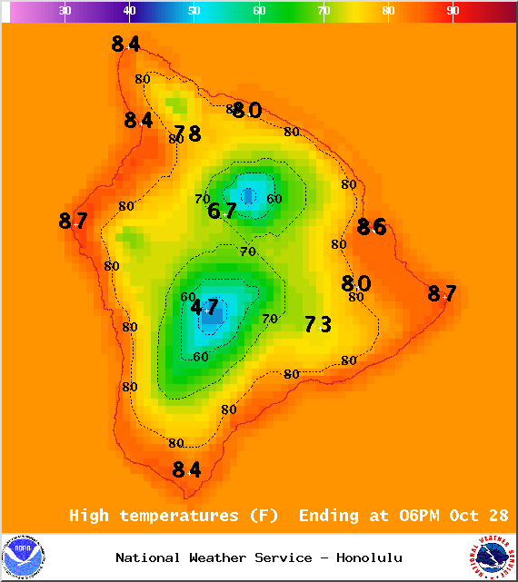
We expect mostly cloudy skies for the east side of the Big Island. Those clouds could be accompanied by pockets of scattered showers. The Kona side should see sunshine early on and light winds, giving way to cloud cover as daytime heating kicks up the sea breeze in the afternoon. Hazy skies are again in the forecast with high temperatures falling in the range of 82° to 87°. Cooler temperatures are expected at higher elevations. In general, east winds should be around 15 mph for Hawai’i County. Along the windward coast, light westerly winds are expected early on, shifting out of the east by the afternoon.
Sunrise: 6:20 a.m.
Sunset: 5:48 p.m.
UV index at 8 (“very high” exposure level)
Tonight
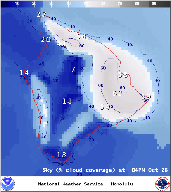
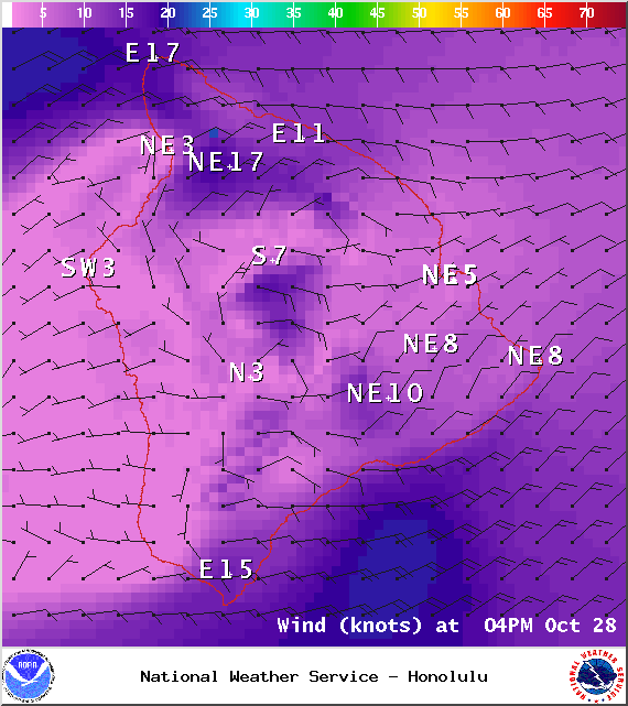
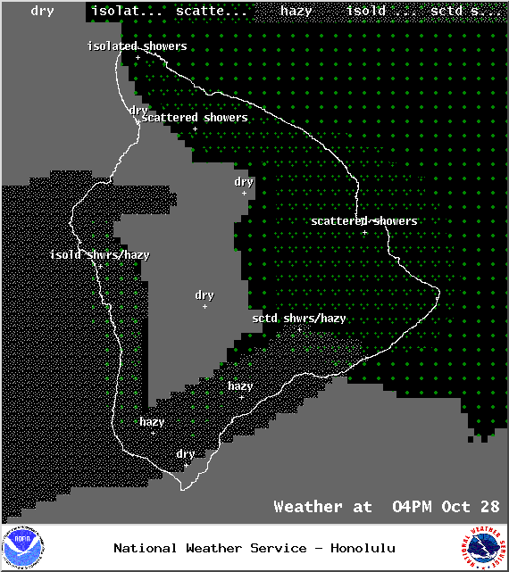
We expect mostly cloudy skies with showers likely in windward and mauka areas. The Kona side will be mostly cloudy to start, then gradually clear as the land breeze takes hold. Low temperatures should fall in the range of 72° to 77° with lower temperatures expected at higher elevations. Winds are expected out of the east at about 15 mph.
ARTICLE CONTINUES BELOW AD
ARTICLE CONTINUES BELOW AD
Moonrise: 10:45 a.m.
Moonset: 10:17 p.m.
Looking Ahead
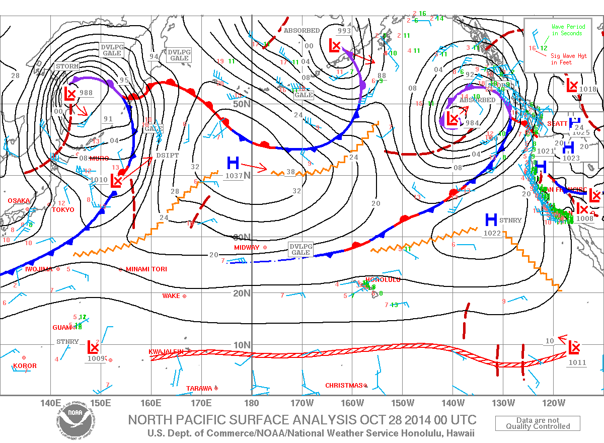
Winds are expected to pick up significantly, maybe as early as Wednesday afternoon. Models are also showing a wet trade wind weather pattern with enhanced windward and mauka showers expected to affect the state starting Thursday night or early Friday (Halloween). Models aren’t quite in agreement yet as to how far south the moisture will extend. For now, it looks like it may not even reach the Big Island. Having said that, there is a disturbance expected in the area during that same time period and that could enhance showers and destabilize the weather a bit. We will keep watching this and bring you the latest as the forecast solutions become more certain about Halloween night.
Surf and Seas Hilo: Surf is expected in the knee to waist high range today, possibly chest high at best exposures. Kona: Only spots that catch a south will see a bump in the surf today. Those spots should see knee to waist high surf early on, maybe even bigger by sundown. South: Building surf throughout the day with knee to waist high surf early on, with some pluses, expected before sunset.
ARTICLE CONTINUES BELOW AD
As expected, former hurricane Ana merged with a storm south of the Aleutians. This will help to boost surf heights for north exposures (340-360°) late Wednesday into Thursday. Another shot of surf energy is expected to possibly fill in on Friday and fade out through the weekend.
Larger short period easterly swells area expected late in the week as trade winds strengthen.
Today, a new south-southwest swell (200-180°) is expected to build. The swell should peak tomorrow and hold through Thursday before fading out. A reinforcing swell is expected over the weekend. After that swell fades out, surf goes quiet with not much on the horizon out of the South Pacific.
ARTICLE CONTINUES BELOW AD
Keep in mind, surf heights are measured on the face of the wave from trough to crest. Heights vary from beach to beach, and at the same beach, from break to break.
Almanac for Hilo Airport Maximum Temperature for today:
Normal 82°
Record 87° / Set in 2003
Minimum Temperature for today:
Normal 68°
Record 62° / Set in 1962
This comments section is a public community forum for the purpose of free expression. Although Big Island Now encourages respectful communication only, some content may be considered offensive. Please view at your own discretion. View Comments


 Today
Today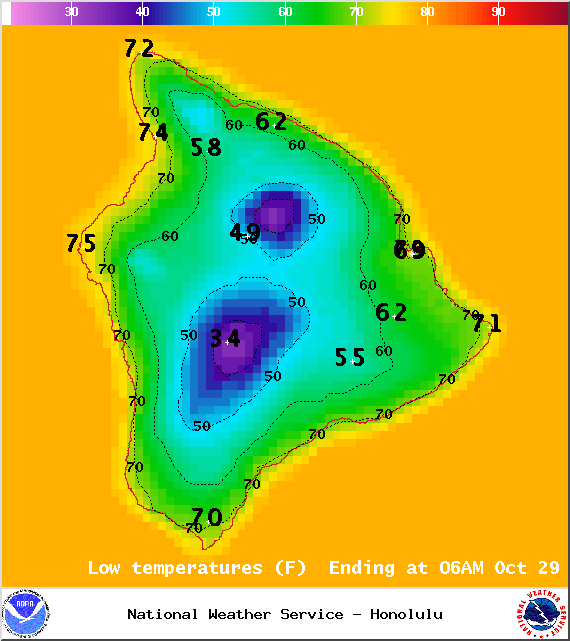 Tonight
 Surf and Seas
 Larger short period easterly swells area expected late in the week as trade winds strengthen.
 Almanac for Hilo Airport