**A breakdown of expected conditions specific to the Big Island is presented below in graphical form. High and low temperatures, swell, percent chance of clouds / rain and wind conditions are each depicted. All graphics are provided by the National Weather Service in Honolulu.**
Alerts
There are no alerts posted for Hawaii County at this time.
Today
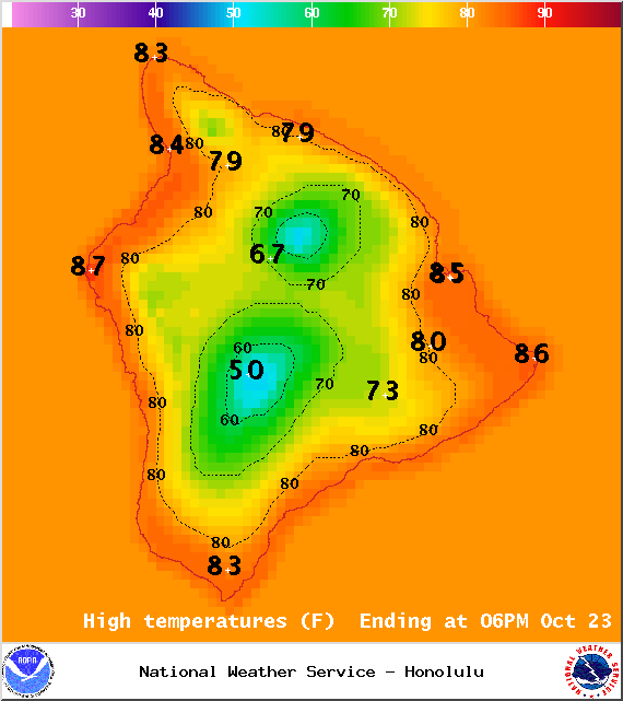
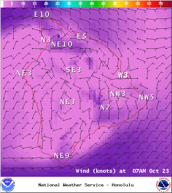
We expect partly sunny skies today with scattered windward and mauka showers, mainly in the early morning and overnight hours. Between 1/4″ and 1/2″ of rain is expected. For the leeward side, mostly sunny skies are in the forecast for the morning, then cloud cover is expected to build in the afternoon. We could see some isolated showers get squeezed out of those clouds in the afternoon and evening. Areas of haze and vog are expected again today. High temperatures should fall in the range of 83° to 88° with cooler temperatures at higher elevations. East winds from 10 to 15 mph are expected, picking up a bit by late in the day.
Sunset tonight is at 5:52 p.m.
ARTICLE CONTINUES BELOW AD
ARTICLE CONTINUES BELOW AD
Sunrise tomorrow is at 6:18 a.m.
The UV index is at 9 (“very high” exposure level).
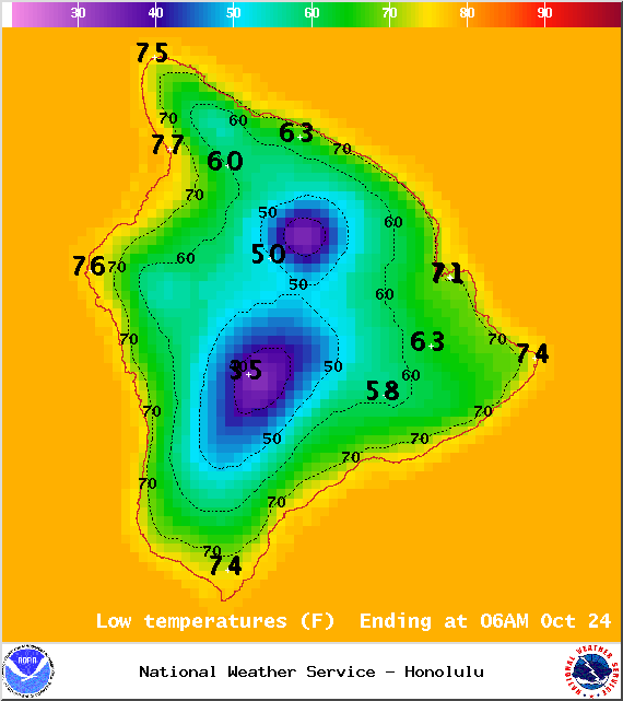
Map of expected overnight low temperatures for Thursday, October 23, 2014 / Image: NOAA / NWS
Tonight
Mostly cloudy skies are expected for windward and leeward spots with scattered showers for windward and mauka areas and isolated showers in leeward locales. Showers will increase as a batch of moisture, currently northeast of the Hawaiian islands, pushes through the state overnight. Low temperatures should fall in the range of 72° to 77° and winds are expected out of the east from 10 to 15 mph.
ARTICLE CONTINUES BELOW AD
Looking Ahead
Muggy conditions are expected through the forecast period. Light trades forecasted for tomorrow should pick up a bit by the evening and into Friday. Ana will merge with a north Pacific low on Saturday which will push our trade wind producing high farther away. That means we expect light east-southeast winds over the weekend. Late each day, showers are likely to be more active than usual as two old cold fronts bring enhanced moisture over the state.
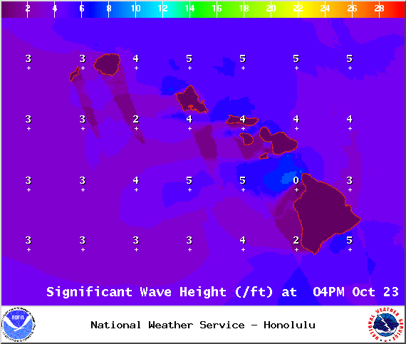
Expected surf heights for Thursday, October 23, 2014 / Image: NOAA / NWS
Surf & Seas
Our current blend of north swells (345-360°) is expected to hold through the morning and begin to fade later in the day. We expect surf heights in the knee to chest high range. Another north-northwest (320-360°) swell is on its heels and expected to begin building by late Thursday, peaking Friday morning and fading through the weekend. A small to moderate reinforcing north swell should arrive late Saturday.
Our small south-southwest (200-190°) swell is lingering, offering knee-to-possibly-waist high waves at our best exposed shores. This swell is expected to start fading Friday, dropping down to trace amounts by the weekend. Gales well southeast of New Zealand could bring larger surf by the middle of next week.
ARTICLE CONTINUES BELOW AD
If Ana continues on its current forecast track, its remnants are expected to merge with a storm to our north. If that happens, we may see some swells generated from Ana. Otherwise, Ana is not looking to be a big swell producer.
All shores will be below advisory levels with surf heights. Only small surf is expected for east facing shores.
Keep in mind, surf heights are measured on the face of the wave from trough to crest. Heights vary from beach to beach, and at the same beach, from break to break.
Expected wind conditions at 7am for Thursday, October 23, 2014 / Image: NOAA / NWS
Almanac for Hilo Airport
Maximum Temperature for today:
Normal 82°
Record 87° / Set in 2003
Minimum Temperature for today:
Normal 68°
Record 64° / Set in 1998, Tied in 2001 & 2008
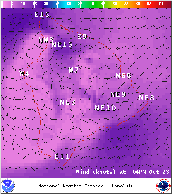
Expected wind conditions at 4pm for Thursday, October 23, 2014 / Image: NOAA / NWS
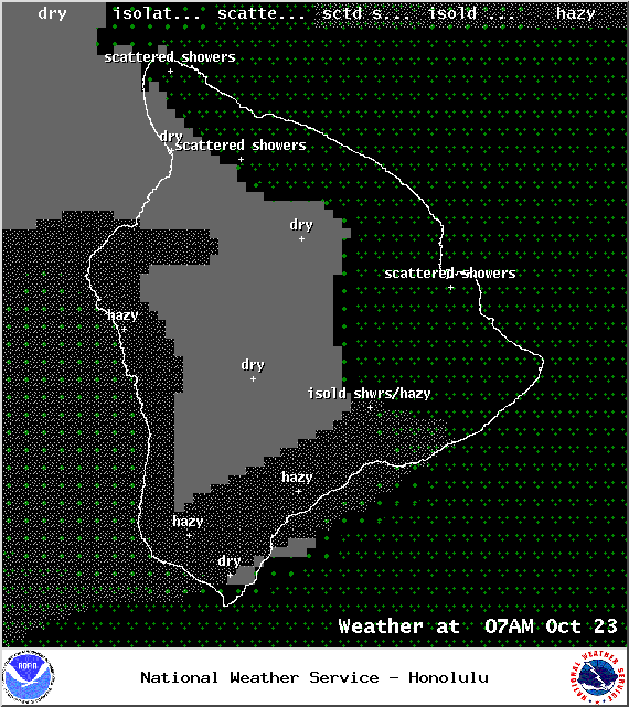
Expected weather conditions at 7am for Thursday, October 23, 2014 / Image: NOAA / NWS
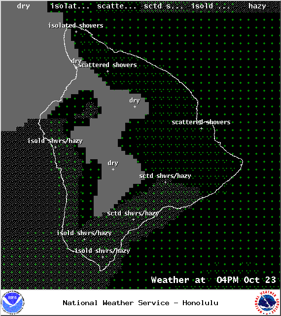
Expected weather conditions at 7pm for Thursday, October 23, 2014 / Image: NOAA / NWS
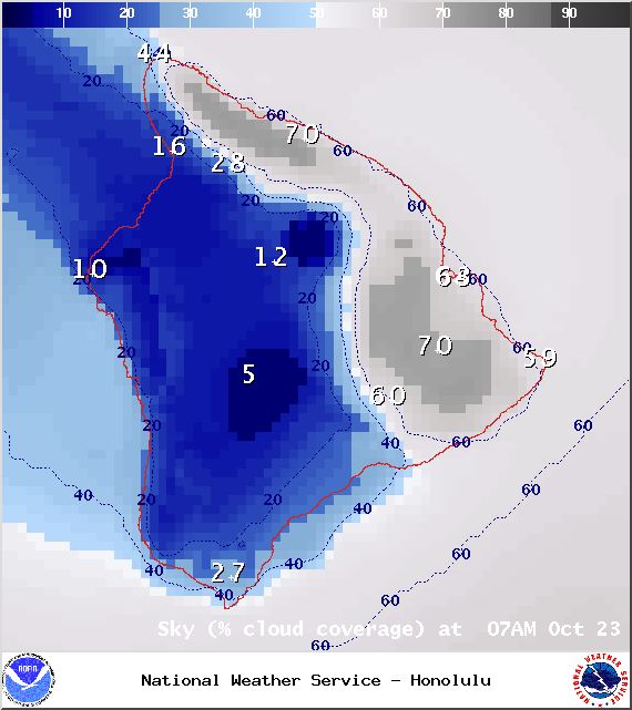
Expected cloud cover at 7am for Thursday, October 23, 2014 / Image: NOAA / NWS
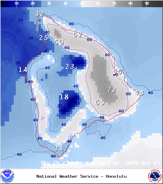
Expected cloud cover at 4pm for Thursday, October 23, 2014 / Image: NOAA / NWS
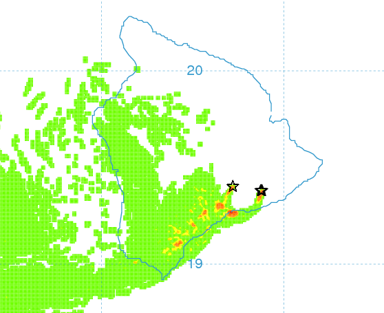
Expected vog conditions for Thursday, October 23, 2014 / Image: NOAA / NWS
This comments section is a public community forum for the purpose of free expression. Although Big Island Now encourages respectful communication only, some content may be considered offensive. Please view at your own discretion. View Comments