There are no alerts posted for Hawai’i County at this time.
Today
We expect partly to mostly cloudy skies today with scattered windward and mauka showers. Less than 1/4″ of rain is expected. For the leeward side, cloud cover is expected to build in the afternoon and prompt pockets of showers.
Map of expected high temperatures for Tuesday, October 21, 2014 / Image: NOAA / NWS
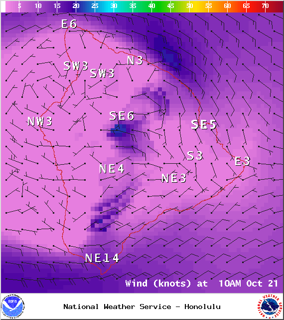
Hazy skies are again in the forecast, especially in the afternoon. High temperatures should fall in the range of 82° to 87° with winds out of the east at about 15 mph. Leeward areas will experience a sea breeze in the afternoon. At higher elevations, temperatures will be a few degrees lower.
ARTICLE CONTINUES BELOW AD
ARTICLE CONTINUES BELOW AD
Sunset tonight is at 5:53 p.m.
Sunrise tomorrow is at 6:17 a.m.
The UV index us listed at 9 (“very high” exposure level).
Map of expected low temperatures for Tuesday, October 21, 2014 / Image: NOAA / NWS
Tonight
Partly to mostly cloudy skies are expected for Hawai’i County tonight with scattered showers. Low temperatures should fall in the range of 72° to 77° and winds are expected out of the east from 10 to 15 mph.
Looking Ahead
ARTICLE CONTINUES BELOW AD
The next few days will see a veering of our winds. Our natural air conditioner will be turned off with light southeasterly winds in the forecast. Muggy conditions are expected. An old front that’s sagging south is expected to bring low clouds and rain as it reaches Hawai’i County sometime late Tuesday into Wednesday. Trade winds may make a return by the weekend, bringing trade wind weather along with them.
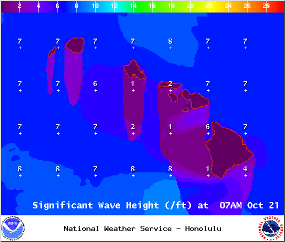
Expected surf heights for Tuesday, October 21, 2014 / Image: NOAA / NWS
Surf & Seas
The above average north-northwest swell should be back down to average levels today, gradually fading through midweek. Today, heights are expected to be head high to overhead at spots best exposed to the swell. A moderate north-northwest swell (320 – 360°) is expected to start building Thursday afternoon. Some northwest swell action from Ana is also possible late in the week.
Swell generated by Ana continues to drop and a small south-southwest (200 – 190°) is expected to build in today, offering heights in the knee to waist high range. Gales well southeast of New Zealand could bring surf by the middle of next week.
ARTICLE CONTINUES BELOW AD
Keep in mind, surf heights are measured on the face of the wave from trough to crest. Heights vary from beach to beach, and at the same beach, from break to break.
Almanac for Hilo Airport Maximum Temperature for today:
Normal 82°
Record 88° / Set in 1992
Minimum Temperature for today:
Normal 68°
Record 63° / Set in 2012
This comments section is a public community forum for the purpose of free expression. Although Big Island Now encourages respectful communication only, some content may be considered offensive. Please view at your own discretion. View Comments