Parts of East Hawaii received nearly two inches of rain Thursday from a low-pressure system that has been hanging around the Big Island for the past several days.
The National Weather Service said the possibility of heavy rains would likely continue until this afternoon when the system is expected to have migrated far enough to the northeast to reduce its impact.
ARTICLE CONTINUES BELOW AD
ARTICLE CONTINUES BELOW AD
Flash flood watches and advisories for the Big Island have been cancelled.
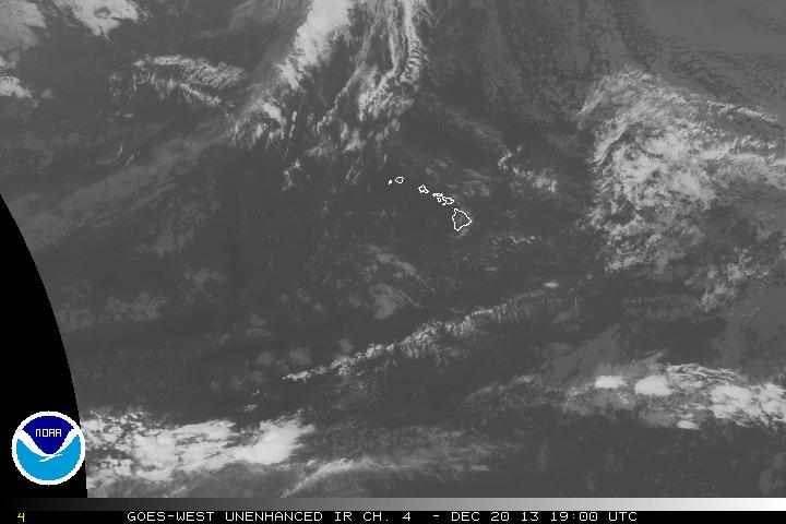
A low-pressure system that brought rain and thunderstorms to the Big Island over the latter part of the week has begun moving away to the northeast (click to enlarge). NOAA image.
The weather service’s gauge at Pahoa received the most rainfall at 1.99 inches during the 24-hour period ending at 8 a.m. today, with more than half of that falling after 8 p.m. Thursday.
Other rainfall totals during that 24-hour period included 1.51 inches at the Hilo airport, 1.57 inches in Waiakea Uka in upslope Hilo and 1.42 inches in Mountain View.
ARTICLE CONTINUES BELOW AD
The forecast for the rest of today was mostly cloudy conditions for both sides of the island, with occasional morning showers increasing in the afternoon for windward areas, and fewer showers over leeward sections.
Posted 5:27 p.m. Thursday, Dec. 19:
An unstable atmosphere was again dumping some rain on the Big Island this afternoon, prompting the National Weather Service to issue its second flash flood advisory in less than 24 hours.
While the rainfall occurred mainly on the island’s leeward side Wednesday, today it was pounding parts of the South Hilo and Puna districts, with Ka`u looking like the next target, the weather service said.
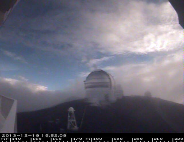
Despite a winter weather warning, the summit of Mauna Kea was mostly snow-free as this webcam image taken shortly before 5 p.m. shows.
The latest flood advisory was in effect until at least 6:30 p.m.
The culprit is a “cold low” being driven toward the Big Island by a high-pressure system further to the northeast of the state.
However, forecasters this morning said the low-pressure area is expected to reverse direction and back off to the northeast on Friday, creating more stable weather conditions.
The forecast for Friday was mostly cloudy with occasional showers on the windward side, with rain more likely at night. For leeward sections, it called for cloudy skies with isolated showers.
A similar pattern is expected over the weekend, except for clearer skies nights and mornings on the leeward side.
***Updated at 5:40 p.m. to show advisory was extended.***
This comments section is a public community forum for the purpose of free expression. Although Big Island Now encourages respectful communication only, some content may be considered offensive. Please view at your own discretion. View Comments